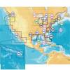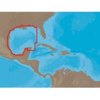
NA-C402 Pensacola Bay to Honduras
Model: NA-C402 Brand: C-Map
C-Map NT+ Cartography is the "next generation" of C-MAP electronic charts, featuring much wider coverage areas at substantially lower prices. NT+ electronic charts are derived from official paper charts. Vastly Expanded Coverage:Important advances in techn
Product Specification
-
Universal Product Identifiers
Part Numbers: 19563, CMANAC402CCARD, CMANAC402FP, C-MAP NA-C402, CW-19563, NA-C402, NA-C402C-CARDGTIN: 000000099677
Related Products
-
958c Combo 36983
-
NSS7 Navigation Pack - NSS7 & 3G Radar 000-10629-001
-
2714 Pathfinder Sart Survival Craft Radar Transponder
-
SD651P Cent Gulf of MX Plat+On M155Sd
-
GPSMAP 78s - Marine, hiking GPS receiver - 2.6" color - 160 x 240
-
010-00737-00 GWS 10 Marine Wind Sensor
-
2896 3ft S-Video Cable DVD DSS SVHS Cable Svideo M/M (24K Gold Plated)
-
2ft 16AWG Power Cord Cable w/ 3 Conductor PC Power Connector Socket (C13/5-15P) - Black
-
E97 Multifunction Display w/Sonar - US Coastal Charts Map
-
B164-20-BL B164 20 Degree Tilted Element Transducer - Blue Co
-
PRO/1000 MT Server Adapter Network adapter - PCI-X hot-plug 133 MHz
-
42985 HDS-8 Gen2 Insight USA w/o XD