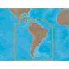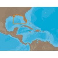
NA-C401 Furuno FP Format - St. Lucie Inlet - LK Pontchart
Model: NA-C401 Brand: C-Map
C-MAP has set the standard for electronic charts with five consecutive NMEA awards for "Best Electronic Cartography". Built on the incredible success of C-MAP NT+, NT+ Wide combines a generation of chartplotters with efficient performance plus real-time accuracy and detail. Now you will be able to see slip detail as well as the locations for onshore facilities. « less
Product Specification
-
Universal Product Identifiers
Part Numbers: 20166, NA-C401FURUNOFPGTIN: 00686074003118
Related Products
-
PMA-DM1-M2 12.5" Dual Mount f/Most Radar Domes - Top F/sa
-
531s - Transducer - included transducer - dual-beam
-
Radar Pole Mount 6' Kit for Raymarine 2KW and 4KW
-
GMR40X XHD 4KW Radar Pedestal W/Cable Reman Noh
-
SA-M504 C-Card Format - South America - Gulf Caribbean
-
T70054 E125 Multifunction Display w/ROW Charts
-
GPSMAP 6012 - Marine Chartplotter - 12.1" color - 1024 x 768
-
700 Series 728 - Fishfinder - included transducer : XNT-9-20-T - dual-beam
-
50ft 24AWG Cat6 550mhz UTP Ethernet Bare Copper Network Cable - Green
-
24inch SATA 6Gbps Cable w/Locking Latch - UV Blue
-
6ft 24AWG CL2 High Speed HDMI Cable w/ Net Jacket - White
-
15ft 14AWG Power Cord Cable w/ 3 Conductor PC Power Connector Socket (C13/5-15P) - Black