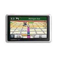
n�vi 1300LMT - Hiking, automotive GPS receiver - 4.3" color - 480 x 272 - widescreen
Model: 1300LMT Brand: Garmin
The thin nüvi 1300LMT has a widescreen display, yet it's slim and light enough to take along on all your travels. This affordable GPS announces streets by name, offers pedestrian navigation options and calculates a more fuel-efficient route with ecoRoute.
Product Specification
-
General
Product Type: GPS receiverRecommended Use: Hiking, automotivePreloaded Maps: Puerto Rico, Hawaii, 48 United StatesCard Reader: microSDInterface: USBFunctions & Services: Distance, elevation, time/dateVoice: Navigation instructions, street name announcementIncluded Software: MapSource City Navigator NTCompatible Software: Garmin CityXplorer, Garmin Travel GuideAntenna: Built-inFirst Seen On Google Shopping: August 2010Features: ecoRoute, built-in speaker, calculator, clock, 2D / 3D map perspective, TMC (Traffic Message Channel) ready, Garmin Lock, photo viewer, custom POIs, downloadable POIs, preinstalled POIs, automatic routing, measurement converter, currency converter, Garmin Garage, Garmin HotFix, Emergency Help -
Display
Type: TFT - color - touch screenDiagonal Size: 4.3" - widescreenWidth: 3.8 inHeight: 2.2 inResolution: 480 x 272Display Illumination: YesFeatures: Anti-glare -
Navigation
Waypoints: 1000Routes: 0Trip Computer: Avoid highways, trip timer, trip distance, quickest route, avoid toll roads, fast/short route, street address search -
Media Player
Supported Image Formats: JPG -
Connections
Interfaces: USB -
Battery
Type: Lithium ionRun Time (Up To): 4 hours -
Miscellaneous
Included Accessories: Dashboard disc, suction cup mount -
Dimensions & Weight
Width: 4.8 inDepth: 0.6 inHeight: 3 inWeight: 5.7 oz -
Universal Product Identifiers
Part Numbers: 010-00782-4Q, 1300LMTGTIN: 00753759970529
Related Products
-
FBRS 2742 Battery Service Include 1098.1 Bat Parts Labor
-
010-C0767-10 Bluechart G2 HEU009RPortugal & Northwest Spain
-
Marine Navigation: Piloting and Celestial and Electronic Navigation [Book]
-
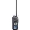
M24 Float 'N Flash HH VHF Marine Radio Submersible IPX7
-
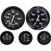
KT9796 Euro 4-Gauge Set (Speed Tach Fuel Volt)
-
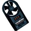
271 Wind Speed INDICATOR, FPM 0 to 8790
-
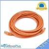
20ft 24AWG Cat5e 350MHz UTP Bare Copper Network Ethernet Cable - Orange
-
Audiopipe Ip2rca12 2 Ch Marine Oxygen Free RCA Cable 12 ft 2 Channel
-
10ft 28AWG High Speed HDMI Cable w/Ferrite cores - Purple
-
7ft 24AWG Cat6a 500mhz Stp Ethernet Bare Copper Network Cable - Blue
-
Marine Products Plug, Stainless Steel, 3/4 9-41205
-
Ite-cbrmrf55d-ptrind1 Mr F55-d Marine Class-D DSC