Max Wide North America & South America C16996
Model: C16996 Brand: C-Map
See Nav - Aids on the screen exactly as they appear through your pilothouse window. Get at-a-glimpse information about current strength and direction. Even view an aerial photograph of an unfamiliar inlet before you enter. MAX gracefully combines unparalleled levels of chart accuracy and detail, striking presentations and a huge collection of new value added data. Building on the incredible success of C-MAP NT+ (voted Best Electronic Charts by the NMEA 6 consecutive years), MAX will infuse a new generation of chart plotters with truly "knockout" performance, lightning fast and real-life accuracy and detail. New Value Added Data Multi-Media Objects such as aerial photos and diagrams of marinas. Seamless Coastal Roads. - Aids can be animated to show their correct flashing light sequence. Now you can see slip detail as well as the locations for onshore facilities. - View and Clear - Info Technology All chart objects are fully prioritized to allow intelligent chart de-cluttering. - Zoom feature allows under zooming of charts with no increase in clutter and over zooming to a much greater magnification than previously possible. Many other manufacturers intend to release MAX products during 2005, so do check that your chart plotter is MAX ready before buying. MAX represents a giant step forward in chart technology that will empower a new generation of chart plotters with knock-out performance, blistering speed and unparalleled levels of accuracy and detail. What is more, the hardware of many existing models of chart plotter are already MAX Ready and can fully support MAX with a simple software update. C-Maps award winning NT+ cartography (NMEA voted Best Electronic Charts for six consecutive years) has also had some great new changes to its catalogue and pricing structure to bring it in-line with MAX. The hundreds of thousands of existing NT+ users will all benefit from these changes and continue to purchase and update NT+ cartridges at even lower prices. By keeping this backward compatibility, C-Map are helping their customers to embrace new technology whilst avoiding the costly expense of having to buy a completely new set of cartridges. As always there will also be a cartridge upgrade or trade-in program for people to move from NT/NT+ to MAX in a cost effective manner. PC-Planner In the early part of next year, C-Map will be updating their popular PC-Planner program to support MAX. It will be possible for existing PC-Planner users to upgrade to the new version. - PC For customers with PC Navigation programs that use our much respected NTon - PC charts, C-Map will release MAXon - PC giving them the power of MAX on their PC. « less
Product Specification
-
Universal Product Identifiers
Part Number: c16996
Related Products
-
2-014 Outdoor US Northeast Chart for Endura Series
-
Max EN-M326 W9 Finland Lakes-MAX
-
MA7500 Compact Box Marine Speaker, 100 Watts (Pair) c13809
-
010-C1024-10 Bluechart G2 HUS401SBermuda Data Card
-
9430 - LowPro2 Manual Release Bracket
-
68362P Amega 4-Gauge Set (SpeedTachFuelVolt)
-
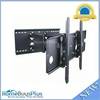
Adjustable Tilting/Swiveling Wall Mount Bracket for LCD LED Plasma (Max 175lbs, 32~60inch) (REV.2.0)
-
5ft 24AWG Cat5e 350MHz UTP Bare Copper Ethernet Network Cable - Pink
-
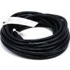
25ft 16AWG Power Cord Cable w/ 3 Conductor PC Power Connector Socket (C13/5-15P) - Black
-
ATA-100/133, FC 40 Pin (80C) x 3, 30 Awg, 40TP Black Round Cable, 18 Inch
-
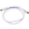
3ft RG6 (18AWG) 75OHM, Quad Shield, CL2 Coaxial Cable with F Type Connector - White
-
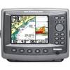
Matrix 97 Combo - Marine Chartplotter - 5.6" color - 320 x 240