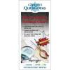
010-C1024-10 Bluechart G2 HUS401SBermuda Data Card
Model: 010-C1024-10 Brand: Garmin
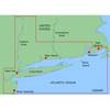
Provides coverage of Bermuda detailing Saint George's Island and Harbour, Harrington Sound, Somerset Island, the Great and Little Sounds, Hamilton Island, and Castle Harbour. See your surroundings more clearly with BlueChart g2 data. With BlueChart g2, you'll get detailed marine cartography that provides convenient viewing of nautical content. BlueChart g2 allows you to see your vessel's precise, on-chart position in relation to naviads, coastal features, anchorages, obstructions, waterways, restricted areas and more. You will also have access to detailed mapping capabilities that include Safety Shading , Fishing Charts , smooth data transition between zoom levels, harmonious transition across chart borders, and reduction of chart discontinuities. « less
Product Specification
-
Universal Product Identifiers
Part Numbers: 010-C1024-10, 10807261, 35819, GAR010C102410GTIN: 00753759095543
Related Products
-
HDS-8 Insight USA Mltfnc 83/200 Fishfinder/Chartplotter 34252
-
53518900 HDS-7 Gen2 Insight USA 50/200kHz
-
MapSource BlueChart - New York - Maps
-
C-Map Max Lakes East NA-M018 c30546
-
How to Read A Nautical Chart: A Complete Guide to the Symbols, Abbrevi
-
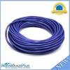
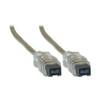
50ft 24AWG Cat6 550mhz UTP Ethernet Bare Copper Network Cable - Purple
-
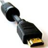
10ft 28AWG High Speed HDMI Cable w/Ferrite cores - Black
-
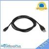
USB 2.0 A Male to Micro-B Male Cable 6 ft.
-
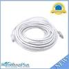
50ft 24AWG Cat5e 350MHz UTP Bare Copper Ethernet Network Cable - White
-
IEEE 1394 cable - 9 pin FireWire 800 - M - 15 ft - PC
-
Trident Marine Hose 3" x 4" Fiberglass Splicer
-
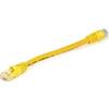
Yellow Six Inch Category 5 Enhanced Cat 5e Ethernet Network Cable .5