As-Interlink Network Connection c28858
Model: c28858 Brand: Humminbird
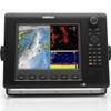
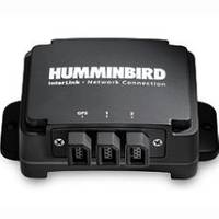
InterLink Network Connection The InterLink System Module networks two Fishing System models together enabling GPS and other accessory data to be shared between the units. The ability to display critical fishing and navigation data on both displays provides time-saving convenience for the user. Key Features Benefits Networks two Fishing Systems and System Modules together. Saves all waypoints and routes within the internal memory of InterLink module for safe keeping. Shares digital information for: Current Position, Speed Over Ground, Course Over Ground, Water Temperature, Auxiliary (livewell) Temperature, Depth, Barometric Pressure, Downrigger Status Note: Only digital information is shared - graphical sonar or charts/map information NOT shared. Data from the Wireless Sonar Link is not shared between units, but can be viewed on one unit. Applications: Boats rigged with two units (bow & console, or helm & flybridge) can share same waypoints, routes and current track. When using the console unit to navigate to a waypoint, will automatically see the waypoint and route appear on the bow unit as they use the trolling motor to close in on the final distance. Larger boats rigged at the console with dual screens (separate chartplotter and fishfinder) can use the GPS capabilities of fishfinder tomark sonar structure, and see the waypoints on both the fishfinder and chartplotter. « less
Product Specification
-
Universal Product Identifiers
Part Number: c28858
Related Products
-
Video SBMARV2DVD DVD Boaters Guide to Using VHF
-
Max EN-M019 MW4 North and Baltic Seas-MAX
-
E15026 Life Tag Wireless Man Overboard System (Extra Tags)
-
NSE8 Navigation Pack - NSE8, GS15 & BR24
-
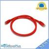
3ft 24AWG Cat6 500mhz Crossover Ethernet Bare Copper Network Cable - Red
-
15ft USB 2.0 A Male to Micro 5pin Male 28/24AWG Cable w/ Ferrite Core (Gold Plated)
-
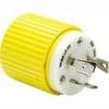
HBL305CRP Xplug 30A 125V B-Line
-
75ft 24AWG Cat6 550mhz UTP Ethernet Bare Copper Network 5026
-
Inc ETS014616911 Computer Hardware
-
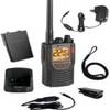
Mr HH 425LI VP Marine Handheld VHF/GMRS Radio w/ Rewind-Say-Again COB-MRHH425LIVP
-
Explorer Plus with GPK-10-6 GPS Antenna
-
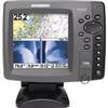
700 Series 798ci SI Combo NVB - Marine Chartplotter - 5" color - 640 x 640