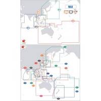
Max Chart for New Zealand in SD Format, M-AU-M001
Model: M-AU-M001 Brand: C-Map
Coverage of New Zealand and Pacific Island's cover's Campbell Island - Cooke Strait - Lake Taupo - New Plymouth - Whangaroa Harbour - West Samoa - Phoenix Island - Papeete,French Polynesia and Cook Island's
Product Specification
-
Universal Product Identifiers
Part Number: AU-M001
Related Products
-
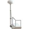
8' Radar Mast Pole Kit with One Stand-Off Kit RM8KT1
-
Radar Mount, Edson Basic Fixed Flybridge Tower System for 8 to 16 Mile Radars
-
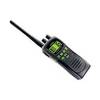
ATLANTIS 250 VHF Two-way radio
-
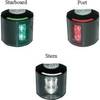
Series 43 White LED Navigation Light Port
-
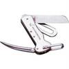
1551 Rigging Knife Deluxe
-
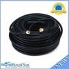
100ft RG6 (18AWG) 75OHM, Quad Shield, CL2 Coaxial Cable with F Type Connector - Black
-
Twist-Lock Power adapter - PC
-
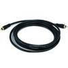
6303 10ft Coaxial Audio/Video RCA Cable M/M RG59U 75ohm (for S/PDIF, Digital Coax, Subwoofer & Composite Video)
-
MMC-00821 Small Water Tight Connector
-
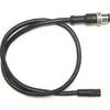
Simnet/Nmea 2000 Adapter Cable c31832
-
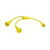
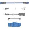
TC44224 Tow Vehicle Side Connector
-
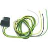
3M Stripped End Spur Cable for SeaTalk NG