Marine navigation: piloting and celestial and electronic navigation [Book]
Product Specification
-
Authors: Richard R. HobbsPages: 703Format: hardbackPublication Date: 1974Key Terms: sextant, Loran-C, celestial navigation, Nautical Almanac, celestial horizon, gyrocompass, U.S. Navy, Notice to Mariners, celestial sphere, echo sounder, IALA, hour angle, Polaris, altitude, latitude, rhumb line, daymarks, nautical charts, radar, buoy
-
Universal Product Identifiers
ISBN: 087021294XGTIN: 09780870212949
Related Products
-
MSD/1XG Gold All USA & Northern Bahamas - SD/MicroSD
-
3Pk Bucktail Teaser Chart - BTCH3
-
010-11091-00 Marine Audio/Video Cable, Right Angle
-
BlueChart g2 - The Netherlands (HEU018R) - Maps
-
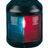
Navigation Light for Bulk Head Mounting , Masthead
-
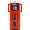
3995.4 Firefly 3 Strobe Same as 3995.3 But Bulk PK
-
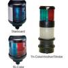
40 Tricolor/Anchor Nav Lite 12/25w
-
50ft 24AWG Cat6 500mhz Crossover Ethernet Bare Copper Network Cable - Gray
-
Cat6a Ethernet Cable | 2ft | Yellow | Network | 10 Gigabit
-
SP-80MT Mechanical Dash Drive w/ Built in Feedback
-
15ft 24AWG CL2 High Speed HDMI Cable w/ Net Jacket - White
-
Orange Six Inch Category 5 Enhanced Cat 5e Ethernet Network Cable .5