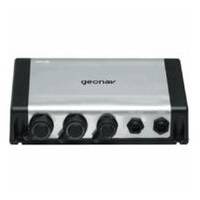
GSM2000 2KW Sonar Module 50/200kHz Side Imaging 40355
Model: GSM2000 Brand: Geonav
2kW Sonar Module with Side Imaging and Down Imaging capability. For deep water use with 600W, 1kW, and 2kW transducers and/or GXD SSI transducer pair available for Side Imaging/Down Imaging - 455 kHz up to 300 feet deep with 480 foot side to side coverage. 12-24 VDC and Ethernet connection. Whats not to love about crystal clarity, multiple coverage options and a dead-giveaway on where fish are hiding? Everything from angling to gunkholing is about to change. Pioneered by Geonavs sister company, Humminbird , Side Imaging and Down Imaging give you amazing, picture-like detailwith side-to-side and straight-down views. Add Side Imaging, Down Imaging and Geonav XD Sonar to your GIS 12 or GIS 10 Integrated Multi-Function Display with the GSM 2000 Sonar Black Box. SIDE IMAGING SONAR Patented Side Imaging technology reveals the entire world beneath the surface with 480 feet of side-to-side coverage. High frequency sonar (not a camera) cuts through murk with crystal clarity, scanning wide areas fast. With full GPS integration, mark the location of promising cover, structure and wrecks as waypoints directly onscreen. Magnify details with multiple zoom levels. DOWN IMAGING SONAR The picture-like views of Down Imaging are created by high-frequency sound waves emitted in razor-thin slices. The resulting sonar returns create an instant snapshot of the activity directly below your vessel. For the most complete story, use Down Imaging and Side Imaging to identify structure or cover, while using traditional XD Sonar to find and target fish. Side Imaging Full Screen Side Imaging Full Screen Down Imaging Full Screen Side Imaging/Down Imaging Split Screen Whats not to love about crystal clarity, multiple coverage options and a dead-giveaway on where fish are hiding? Everything from angling to gunkholing is about to change. Pioneered by Geonavs sister company, Humminbird , Side Imaging and Down Imaging give you amazing, picture-like detailwith side-to-side and straight-down views. Add Side Imaging, Down Imaging and Geonav XD Sonar to your GIS 12 or GIS 10 Integrated Multi-Function Display with the GSM 2000 Sonar Black Box. SIDE IMAGING SONAR Patented Side Imaging technology reveals the entire world beneath the surface with 480 feet of side-to-side coverage. High frequency sonar (not a camera) cuts through murk with crystal clarity, scanning wide areas fast. With full GPS integration, mark the location of promising cover, structure and wrecks as waypoints directly onscreen. Magnify details with multiple zoom levels. DOWN IMAGING SONAR The picture-like views of Down Imaging are created by high-frequency sound waves emitted in razor-thin slices. The resulting sonar returns create an instant snapshot of the activity directly below your vessel. For the most complete story, use Down Imaging and Side Imaging to identify structure or cover, while using traditional XD Sonar to find and target fish. Customizable Color Palettes Tailor the color palette to your unique needs and situation with selectable colour palettes. Time Variable Gain Control Use Geonavs pre-programmed gain level or tweak it to get the exact sonar returns youre looking for. Instant Screen Capture See something you like? Take an instant screen snapshot and save it to an SD memory card as a future point of interest. Automatic Noise Rejection Filter out interference from the engine and other sources automatically. Integrated Waypoint Storage Save interesting sonar echoes as latitude/longitude reference points for fishing or navigational safety. Sonar Zoom With the touch of a button, adjust your views upper and lower range limits or zoom up and down the water column. « less
Product Specification
-
Universal Product Identifiers
Part Number: 40355
Related Products
-
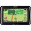
RoadMate 2036 - Automotive GPS receiver - 4.3" color - 480 x 272
-
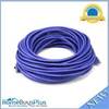
75ft 24AWG Cat5e 350MHz UTP Bare Copper Ethernet Network Cable - Purple
-
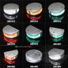
LED Navigation Lights, Single Port Rnd Vessel Size 165 Each
-
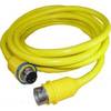
50 Amp 50' Cord Set - Yellow - 125/250V
-
Patch cable - CAT 5e - RJ-45 - M - Shielded twisted pair (STP) 100 ft - Gray
-
1.5ft Premium 2.5mm Stereo Male to 2rca Male 22AWG Cable
-
DCH Harness for DC Style Gauge
-
Marine Products Plug Wire Set 9-28004
-
LTB-SS Light Bar Stainless Steel PYILTBSS
-
LTB-SS Stainless Steel Light GPS Bar
-
1TWA2002 9' Air Marine Aluminum Pole Set
-
Air 30 24V Wind Turbine 1-AR30-10-24