MapSource BlueChart - The Gulf and Red Sea - Maps
Model: Brand: Garmin
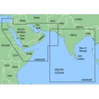
MapSource BlueChart is Garmin's exclusive marine cartography and was developed to provide you with mapping flexibility and options you've never had before. This line of cartography products is designed to provide interactive viewing of detailed nautical chart data, thereby providing navigators with innovative object-oriented cartography. These detailed electronic nautical charts look just like paper charts when displayed on your Garmin chartplotter. Features include shading between depth contours, spot soundings, navaids, port plans, wrecks, obstructions, inter-tidal zones, and more. BlueChart offers much larger coverage areas for half the price. MapSource BlueChart The Gulf and Red Sea covers of the Arabian Penninsula beginning at the Mediterranean Sea from Beirut to Alexandria. Coverage includes the Suez Canal, Gulf of Aqaba, and the Red Sea and Gulf of Aden in their entirety. Includes the Strait of Hormuz, Gulf of Oman, and coast of Somalia in the south. Coverage the of Kuwait, Saudi Arabia, Qatar, United Arab Emirates, along the southern coast of the Gulf and Iran along the northern coast. Coverage of Yemen and Oman coasts along the Indian Ocean to the Gulf of Oman, including Pakistan along the north coast, with general coverage of the Arabian Sea from Qamar Bay to the Delta of the Indus River. Included in this overall general coverage are numerous detailed charts covering areas such as Alexandria, Egy., Beirut, Leb., Al-Fuhaihil, Ad- Dammam, Bahrain, Ad-Dauha, and Abu Dhabi.Jiddah, Sau., Djibouti, Dji., and Aden, Yem. « less
Product Specification
-
General
Product Type: MapsDistribution Media: microSD Memory CardFirst Seen On Google Shopping: January 2006 -
Compatibility Information
Designed For: Garmin eTrex Legend Cx, Vista Cx Garmin GPSMAP 60CSx, 60Cx, 76CSx, 76Cx -
Universal Product Identifiers
Part Numbers: 010-C0415-00, The Gulf and Red SeaGTIN: 00753759056414
Related Products
-
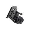
Marine Mount - GPS receiver mount bracket
-
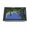
G10 10" Multifuntion Display w/Built in 2KW Sonar 40341
-
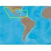
NA-M027 SD Card Format Central America & Car
-
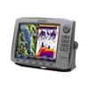
HDS-10 - Marine Chartplotter - 10.4" color - 800 x 600
-
9469 17 Foot Harness for 2nd Station on 1946
-
4122 San Diego/Oceanside - Coronado
-
ACR Replacement Antenna for Satellite 406 #9322
-
50 Amp 50' Cord Set - White - 125/250V
-
SP36-5 Autopilot w/ Rate Comp Rotary Feedback 18CI Pump
-
10.0 Beg Generator
-
Cat6a Ethernet Cable | 1ft | Red | Network | 10 Gigabit
-
788ci High Definition Combo Internal GPS Antenna & Fishfinder with Transom Mount Transducer