MapSource BlueChart - Chesapeake - Maps
Model: Brand: Garmin
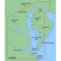
MapSource BlueChart is Garmin's exclusive marine cartography and was developed to provide you with mapping flexibility and options you've never had before. This line of cartography products is designed to provide interactive viewing of detailed nautical chart data, thereby providing navigators with innovative object-oriented cartography. These detailed electronic nautical charts look just like paper charts when displayed on your Garmin chartplotter. Features include shading between depth contours, spot soundings, navaids, port plans, wrecks, obstructions, inter-tidal zones, and more. BlueChart offers much larger coverage areas for half the price. MapSource BlueChart Chesapeake provides detailed coverage of Baltimore through Virginia Beach, including the entire Chesapeake Bay, the C&D canal, Norfolk and Cape Charles. « less
Product Specification
-
General
Product Type: MapsDistribution Media: microSD Memory CardFirst Seen On Google Shopping: January 2006 -
Compatibility Information
Designed For: Garmin eTrex Legend Cx, Vista Cx Garmin GPSMAP 60CSx, 60Cx, 76CSx, 76Cx -
Universal Product Identifiers
Part Numbers: 010-C0341-00, 010-C0379-00, ChesapeakeGTIN: 00753759055707
Related Products
-
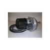
Dashboard Autopilot Drives for Cable Steering 12V 29010002
-
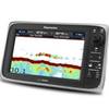
E97 Multifunction 9" Display with Sonar - No Charts E70022
-
C97 Multifunction 9" Display with Sonar - US Coastal Charts T70021 c44326
-
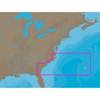
NA-C304 C-Card Format Norfolk Bermuda Jacksonuville
-
Max Lakes North NA-M017 c30544
-
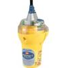
Category II Smartfind Plus EPIRB
-
15ft 32AWG Mini DisplayPort Cable - White
-
C125 Multifunction Display w/US Coastal Charts Map
-
B75-0-L Broadband Chirp 0 Degree Tilt, No CONNECTOR, Depth & Temperature Thru-Hull Tilted
-
809-0916 AGS Automatic Generator Start F First Gen
-
PC/NMEA/SeaTalk Interface Box E85001
-
GPSMAP 520s - Marine GPS receiver - 5" color - 240 x 320