MapSource BlueChart - Anchorage to Juneau - Maps
Model: Brand: Garmin
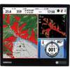
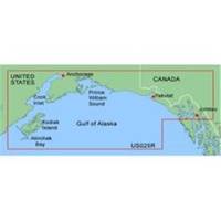
MapSource BlueChart is Garmin's exclusive marine cartography and was developed to provide you with mapping flexibility and options you've never had before. This line of cartography products is designed to provide interactive viewing of detailed nautical chart data, thereby providing navigators with innovative object-oriented cartography. These detailed electronic nautical charts look just like paper charts when displayed on your Garmin chartplotter. Features include shading between depth contours, spot soundings, navaids, port plans, wrecks, obstructions, inter-tidal zones, and more. BlueChart offers much larger coverage areas for half the price. MapSource BlueChart Anchorage to Juneau provides detailed coverage from Juneau to Alinchak Bay includes Kodiak Island, Cook Inlet, Prince William Sound, Yakutat, Glacier Bay and Icy Strait. « less
Product Specification
-
General
Product Type: MapsDistribution Media: Garmin Data CardFirst Seen On Google Shopping: January 2006 -
Universal Product Identifiers
Part Numbers: 010-C0039-00, Anchorage to JuneauGTIN: 00753759031855 -
Compatibility Information
Designed For: Garmin GPSMap 172C, 176, 176C, 178C, 178C Sounder, 182, 182C, 188 Sounder, 188C Sounder, 196, 2006, 2006C, 2010, 2010C, 2106C, 2110C, 2206C, 2210C, 232, 238 Sounder, 276C, 292C, 296, 298C, 3006C, 3010c, 3205C, 3206C, 3210C, 376C, 392C, 396C, 492C, 498C
Related Products
-
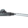
1441 HANDI- Mate O.B. Handle w/Swivel
-
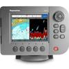
E62188 A57D 5.7" Combo, No Charts, Int GPS
-
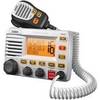
UM-525 GPS Intuitive Fixed Mount VHF/Loud Hailer Marine Radio - White
-
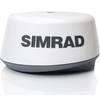
BR24 Broadband Radar for NSE-Series 20m Cable #AA010221
-
2714 Pathfinder Sart Survival Craft Radar Transponder
-
Genuine Cobra Ite-t50421-dbd1 Marine VHF Handheld Radio 10
-
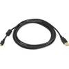
6ft USB 2.0 A Male to B Male 28/24AWG Cable - (Gold Plated)
-
25ft 24AWG Cat5e 350MHz UTP Bare Copper Ethernet Network Cable - Yellow
-
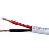
50ft 12AWG CL2 Rated 2-Conductor Loud Speaker Cable (for In-Wall Installation)
-
10ft USB 2.0 A Male to Micro 5pin Male 28/24AWG Cable w/ Ferrite Core (Gold Plated)
-
ATA-100/133, FC 40 Pin (80C) x 3, 30 Awg, 40TP Black Round Cable, 18 Inch
-
NSO15 Package - Monitor, Marine Processor, Remote, and SD Card Reader 41216