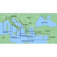
MapSource BlueChart - Adriatic Sea, South Coast - Maps
Model: Brand: Garmin
MapSource BlueChart is Garmin's exclusive marine cartography and was developed to provide you with mapping flexibility and options you've never had before. This line of cartography products is designed to provide interactive viewing of detailed nautical chart data, thereby providing navigators with innovative object-oriented cartography. These detailed electronic nautical charts look just like paper charts when displayed on your Garmin chartplotter. Features include shading between depth contours, spot soundings, navaids, port plans, wrecks, obstructions, inter-tidal zones, and more. BlueChart offers much larger coverage areas for half the price. MapSource BlueChart Adriatic Sea, South Coast provides detailed coverage of Italian coast from Porto Civitanova to extend south to Siracusa, Sicilia. From Split, Croatia to Killini, Greece. « less
Product Specification
-
General
Product Type: MapsDistribution Media: Garmin Data CardFirst Seen On Google Shopping: January 2006 -
Compatibility Information
Designed For: Garmin GPSMap 172C, 176, 176C, 178C, 178C Sounder, 182, 182C, 188 Sounder, 188C Sounder, 196, 2006, 2006C, 2010, 2010C, 2106C, 2110C, 2206C, 2210C, 232, 238 Sounder, 276C, 292C, 296, 298C, 3006C, 3010c, 3205C, 3206C, 3210C, 376C, 392C, 396C, 492C, 498C -
Universal Product Identifiers
Part Numbers: 010-C0107-00, Adriatic Sea, South Coast
Related Products
-
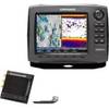
44488 HDS-8 Gen2 Insight LSS-2 HD Bundle
-
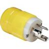
4721CR Marine Electrical Plug 15-Amp Locking
-
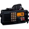
GX5500S Two-Way Radio,marine,25 Watts 4lpt6
-
BlueChart g2 Vision - Adriatic Sea, North Coast - Maps
-
Max AU-M207 W61 Papua New Guinea-MAX
-
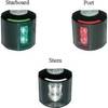
Series 43 White LED Navigation Light Stern
-
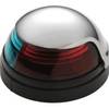
5045SS7 Stainless Steel Deck Mount Navigation Light
-
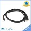
3ft eSATA + USB to Esatap Cable - Black
-
SP36-5 Autopilot w/ Rate Comp Rotary Feedback 18CI Pump
-
Whisper 36 Inch Galvanized Augers Set of Four Earth Anchors
-
Digital 100' DA340 Cable w/Connectors
-
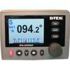
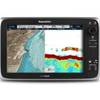
C127 Multifunction Display w/Sonar - US Coastal Charts Map