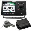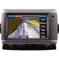
GPSMAP 720 GPS Chartplotter with Internal GPS Antenna 010-00835-00
Model: 010-00835-00 Brand: Garmin
These stand-alone touchscreen chartplotters feature a brilliant 7" color display and includes an internal high-sensitivity GPS receiver for superior satellite tracking and quicker acquisition times. The intuitive touchscreen interface makes operation simple and the widescreen display is waterproof and built to last. With a built-in radar port it is easy to add one of the GMR marine radar systems. Addition of the GXM 51 antenna enables graphical weather data for North America & XM satellite radio. Other features include AIS support DSC position display audible alarms tide tables sun & moon informationa NMEA 0183 & 2000 interface and more. 3000 Waypoints 100 routes 20000 points 50 saved tracks. Standard models are GPS/Chartplotters and do not include sonar capability. S models include a powerful dual frequency 200/50kHz sonar transceiver to help you define fish and underwater structures as deep as 2000' when used with a 1kW transducer. Transducers sold separately. 720/720s include a worldwide basemap. 740/740s include the basemap plus U.S. Coastal maps including Alaska & Hawaii as well as detailed Bahamas charts. « less
Product Specification
-
Universal Product Identifiers
Part Number: 100083500
Related Products
-
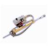
Pump LA17-12 12V Type 2 Linear Drive Unit
-
Package(e95 with aus, NZ, S. America, Asia Chart, 4KW 24 Inch Digital Radome & Radar Cable)
-
NA-C401 C-Card Format - St. Lucie Inlet LK Pontch
-
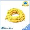
75ft 24AWG Cat5e 350MHz UTP Bare Copper Ethernet Network Cable - Yellow
-
PFD 33 Gram Manual Inflatable Chest Pak in Navy Size: Large / X-Large
-
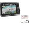
Navpilot700ob Autopilot Outboard Requires Pump
-
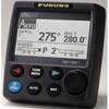
000-10577-001 AP70 Autopilot Pack w/AP70, AC70, RF300 & Require
-
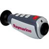
E70032 TH24 240 x 180 Thermal Marine Scope
-
100ft 24AWG Cat6a 500mhz Stp Ethernet Bare Copper Network Cable - Blue
-
6ft Premier Series XLR Female to RCA Male 16AWG Cable (Gold Plated)
-
6ft Toslink to Mini M/M 5.0mm OD Molded Cable 1557
-
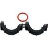
010-11170-02 - Split Collar w/ 14.5mm Connector