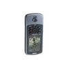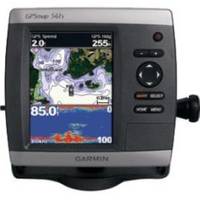
GPSMAP 541s - Marine GPS receiver - 5" color - 234 x 320
Model: 541s Brand: Garmin
The GPSMAP 541s is a compact chartplotter that features an ultra-bright 5" QVGA display along with an improved high-speed digital design for increased map drawing and panning speeds. It's ready to go with an easy-to-use interface and a built-in, satellite-enhanced base map.
Product Specification
-
General
Product Type: GPS receiverRecommended Use: MarinePreloaded Maps: USACard Reader: SD Memory CardInterface: NMEA 0183, NMEA 2000Compatible Software: BlueChart g2 VisionAntenna: Built-inFeatures: Depth sounder, alarm, 2D / 3D map perspective -
Display
Type: LCD - colorDiagonal Size: 5"Resolution: 234 x 320 -
Navigation
Waypoints: 3000Tracks: 50Tracklog Points: 10000Routes: 100Trip Computer: Sunrise/sunset times, sun/moon positions -
Connections
Interfaces: Antenna -
Miscellaneous
Design Features: Rugged caseProtection: WaterproofWaterproof Standard: IPX7Included Accessories: Protective cover, mounting bracket, power/data cable -
Dimensions & Weight
Width: 5.9 inDepth: 2.9 inHeight: 6.4 inWeight: 1.8 lbs -
Universal Product Identifiers
Part Numbers: 010-00762-01, 010-00762-02, 541sGTIN: 00000100076202, 00753759096052
Related Products
-
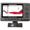
iScan V90 Forward Looking Sonar 16407
-
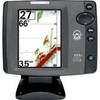
700 Series 777c2 CHO - Fishfinder - optional transducer - dual-beam
-
Marine World Chart of Nicolo de Canerio Januensis 1502 Circa a Critical Study [Book]
-
Cal June 722 Safety Harness Child
-
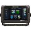
00010771001 HDS-9 Touch G2 Insight 83/200
-
Hook & Loop Fastening Cable Ties 6inch, 100pcs/Pack - White
-
Patch cable - CAT 5e - RJ-45 - M - Unshielded twisted pair (UTP) 25 ft - Yellow
-
T&H Marine -SA-2B-DP Scupper Blk/White
-
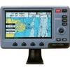
E97 Multifunction Display w/Sonar - US Coastal Charts Map
-
TM258-8F 1kW 50/200 kHz Transom Mount Transducer 8F Connector
-
GPSMAP 76 - Marine, hiking GPS receiver - Monochrome - 240 x 180
-
Colormax Wide External 7 Inch Color LCD GPS / WAAS Charting sys