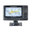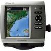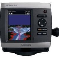
GPSMAP 431 - Marine GPS receiver - 4" color - 240 x 320
Model: 431 Brand: Garmin
The GPSMAP 431 is a compact chartplotter that features an ultra-bright 4" QVGA color display along with an improved high-speed digital design for increased map drawing and panning speeds. The GPSMAP 431 accepts BlueChart g2 vision cards for added features and functionality such as high-resolution satellite imagery, 3-D views and Auto Guidance technology. « less
Product Specification
-
General
Product Type: GPS receiverRecommended Use: MarineCard Reader: SD Memory CardInterface: NMEA 0183Functions & Services: Tide TabIncluded Software: MapSource BlueChart Inland Lakes: United StatesCompatible Software: BlueChart g2 VisionAntenna: Built-inFeatures: Alarm, 2D / 3D map perspectiveFirst Seen On Google Shopping: May 2010 -
Display
Type: LCD - colorDiagonal Size: 4"Resolution: 240 x 320 -
Navigation
Waypoints: 3000Tracks: 50Tracklog Points: 10000Routes: 100Trip Computer: Sun/moon positions -
Miscellaneous
Protection: WaterproofWaterproof Standard: IPX7Included Accessories: Protective cover, mounting bracket, power/data cable -
Dimensions & Weight
Width: 5.7 inDepth: 2.7 inHeight: 5 inWeight: 1.3 lbs -
Universal Product Identifiers
Part Numbers: 010-00765-00, 431GTIN: 00753759095888
Related Products
-
15342 Chart Master 169CS Wide Screen Chart Plotter
-
Fishin' Buddy 110 - Fishfinder - included transducer - single-beam
-
Max RS-M202 W36 Russian Federation NW-MAX
-
22096366 - Control Head for AP28
-
Human Resources and Crew Resource Management: Marine Navigation and Safety of Sea Transportation [Book]
-
Navigation Light [Book]
-
8ft 28AWG High Speed HDMI Cable w/Ferrite cores - Black
-
30ft 24AWG Cat6 550mhz UTP Ethernet Bare Copper Network 5017
-
117A Adapter 50A/250-30A/125 Lock
-
10.0 Sbeg Generator
-
GPSMAP 526 - Marine Chartplotter - 5" color - 480 x 640
-
GC10 Standard Image NTSC Marine Camera