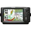
GPSMAP 526 - Marine Chartplotter - 5" color - 480 x 640
Model: 526 Brand: Garmin
The GPSMAP 526 is a compact chartplotter that features a high-resolution, super-bright 5" VGA display along with an improved high-speed digital design for increased map drawing and panning speeds. It's ready to go with a built-in, satellite-enhanced worldwide basemap. The GPSMAP 526 also accepts BlueChart g2 vision cards for added features and functionality such as high-resolution satellite imagery, 3-D views and Auto Guidance technology. « less
Product Specification
-
General
Product Type: ChartplotterRecommended Use: MarineCard Reader: SD Memory CardInterface: NMEA 0183, NMEA 2000Included Software: Garmin Worldwide Marine BasemapCompatible Software: BlueChart g2 VisionAntenna: Built-inFeatures: Alarm, 2D / 3D map perspective, XM Satellite Radio support, XM weather supportFirst Seen On Google Shopping: December 2009 -
Display
Type: LCD - colorDiagonal Size: 5"Resolution: 480 x 640Features: Anti-glare -
Navigation
Waypoints: 3000Tracks: 50Tracklog Points: 20000Routes: 100Trip Computer: Sun/moon positions -
Connections
Interfaces: Antenna - BNC -
Miscellaneous
Protection: WaterproofWaterproof Standard: IPX7Included Accessories: Protective cover, mounting bracket, power/data cable -
Dimensions & Weight
Width: 5.9 inDepth: 2.9 inHeight: 6.4 inWeight: 1.8 lbs -
Universal Product Identifiers
Part Numbers: 010-00772-00, 526GTIN: 00753759096106
Related Products
-
G10 10" Multifuntion Display w/Built in 2KW Sonar 40341
-
4G Broadband Radar with 10M Cable 000-10419-001 c42913
-
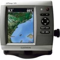
Fishfinder 160C - Fishfinder - included transducer - dual-beam
-
Adjustable Tilting/Swiveling Wall Mount Bracket for LCD LED Plasma (Max 175lbs, 32~60inch) (REV.2.0)
-
Marine Navigation and Safety of Sea Transportation [Book]
-
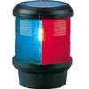
Navigation Light Tri Color Pedestal Mount
-
8001566 Navigation Light LED Replacement Bulbs: Festoon Star
-
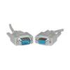
Serial cable - (DB-9) - M - (DB-9) - F - 50 ft - PC
-
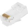
GC7266 Solid Cat6 RJ45 Plug (100-Pack)
-
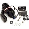
HST-DFSBL TM 50/200 Depth and Temp Blue Connector
-
HS5 SeaTalk hs Network Switch, A80007 c44691
-
958C Combo 407750-1