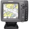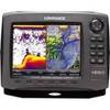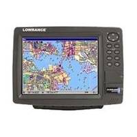
GlobalMap 9200C - Marine GPS receiver - 10.4" color - 600 x 800
Model: 9200C Brand: Lowrance
Huge 10.4" display, networking and GPS chartplotter performance features, including newly-expanded built-in background map of the continental U.S. and Hawaii with over 3,000 lakes with depth contours. Also compatible with Lowrance radar!
Product Specification
-
General
Product Type: GPS receiverRecommended Use: MarinePreloaded Maps: USA, HawaiiReceiver: 12 channelCard Reader: SD Memory CardInterface: Serial, NMEA 0183, NMEA 2000Functions & Services: MOB (Man Overboard)Compatible Software: Lowrance NauticPath USA Marine Electronic Charts, Lowrance Fishing Hot Spots Elite, Lowrance FreedomMaps USA Topo, Lowrance LakeMaster Pro Maps, Lowrance MapCreate USA Topo, Navionics chartsSBAS: WAASAntenna: ExternalFeatures: Backlit keypadFirst Seen On Google Shopping: August 2007 -
Display
Type: TFT - colorDiagonal Size: 10.4"Resolution: 600 x 800Display Illumination: Yes -
Navigation
Waypoints: 1000Tracks: 100Tracklog Points: 10000Routes: 100Waypoints per route: 100 -
Connections
Interfaces: Serial Ethernet -
Miscellaneous
Protection: Waterproof -
Dimensions & Weight
Width: 12.2 inDepth: 4 inHeight: 9.1 in -
Manufacturer Warranty
Service & Support: 1 year warranty -
Universal Product Identifiers
Part Numbers: 123-24, 9200CGTIN: 00042194529165
Related Products
-
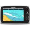
700 Series 786ci - Marine Chartplotter - 5" color - 640 x 640
-
T70023 C97 Multifunction Display w/Sonar - European Charts
-
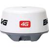
4G Broadband Radar Dome with 20m Cable c42562
-
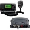
VHF 100 & AIS 300 Marine Communication Bundle K10-00169-00
-
The sea chart: the illustrated history of nautical maps and navigational charts [Book]
-
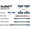
A25062 SeaTalkNG Backbone Cable Kit for ST70
-
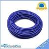
75ft 24AWG Cat6 550mhz UTP Ethernet Bare Copper Network Cable - Purple
-
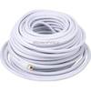
100ft RG6 (18AWG) 75OHM, Quad Shield, CL2 Coaxial Cable with F Type Connector - White
-
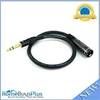
1.5ft Premier Series XLR Male to 1/4inch TRS Male 16AWG Cable (Gold Plated)
-
1852061 MKR-US2-1 Garmin Adapter Cable
-
TS-1BL Temp Sensor Blue Connector wts1bl
-
42985 HDS-8 Gen2 Insight USA w/o XD