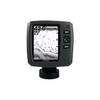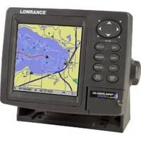
GlobalMap 5300C iGPS - Marine GPS receiver - 5" color - 480 x 480
Model: 5300C Brand: Lowrance
Product Specification
-
General
Product Type: GPS receiverRecommended Use: MarinePreloaded Maps: USA, HawaiiReceiver: 12 channelCard Reader: SD Memory CardInterface: NMEA 0183, NMEA 2000Functions & Services: MOB (Man Overboard)Compatible Software: Lowrance NauticPath USA Marine Electronic Charts, Lowrance Fishing Hot Spots Elite, Lowrance FreedomMaps USA Topo, Lowrance LakeMaster Pro Maps, Lowrance MapCreate USA TopoSBAS: WAASAntenna: Built-inUpdate Rate: 1/secondFeatures: Backlit keypadFirst Seen On Google Shopping: August 2007 -
Display
Type: TFT - colorDiagonal Size: 5"Resolution: 480 x 480Display Illumination: Yes -
Navigation
Waypoints: 1000Tracks: 10Tracklog Points: 9999Routes: 100Waypoints per route: 100 -
Connections
Interfaces: Serial - RS-232 -
Miscellaneous
Protection: WaterproofIncluded Accessories: SD Card -
Dimensions & Weight
Width: 6.9 inDepth: 3.4 inHeight: 5.4 in -
Manufacturer Warranty
Service & Support: 1 year warranty -
Universal Product Identifiers
Part Numbers: 116-29, 5300C iGPSGTIN: 00042194529578
Related Products
-
Fishfinder echo 200 - Fishfinder - included transducer - dual-beam
-
NA-C804 Furuno FP Format Northern Alaska
-
NT Pass BAY-NANTUCKET NAC301
-
010-00756-00 VHF 300 Marine Radio
-
Auto Pilot S1g/St8001 Inboard E12121
-
14ft 24AWG Cat6 550mhz UTP Ethernet Bare Copper Network Cable - Orange
-
Navigation Light [Book]
-
SP-80MT Mechanical Dash Drive w/ Built in Feedback
-
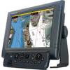
MFDBB NavNet 3D Black Box Multi Function Display Processor
-
Cat6a Ethernet Cable | 50ft | Blue | Network | 10 Gigabit
-
VHF 200 25W VHF Radio 010-00755-00
-
Smartfind Plus G5 GPS EPIRB Cat I 29953