NA-C804 Furuno FP Format Northern Alaska
Model: NA-C804 Brand: C-Map
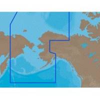
With are Electronic Sharts C-Maps we have: Olympia, Washington to Port Mcneill, British Columbia. Nannose to Victoria to Cape Scott Texada Island to Caamano Sound Cape Caution to Portland Canal Banks Island, British Columbia to Sumner Strait, Alaska Dixon Entrance to Icy Bay Gulf of Alaska Western Alaska NA-C804 Western Alaska NT+ Cartography NT+ electronic charts feature much wider coverage areas at substantially lower prices. « less
Product Specification
-
Universal Product Identifiers
Part Numbers: 20186, NA-C804FURUNOFP
Related Products
-
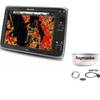
Package(e125 with USA Coastal Chart, 4KW 24 Inch Digital Radome & Radar Cable)
-
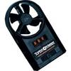
271 Wind Speed INDICATOR, FPM 0 to 8790
-
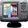
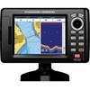
Elite 5 Gold Combo Fishfinder/Chartplotter
-
10ft 24AWG CL2 High Speed HDMI Cable w/ Net Jacket - Black
-
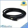
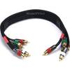
1.5ft 18AWG CL2 Premium 5-rca Component Video/audio Coaxial Cable (RG-6/U) - Black
-
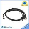
3ft eSATA + USB to Esatap Cable - Black
-
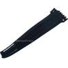
Hook & Loop Fastening Cable Ties 9inch, 10pcs/Pack - Black
-
5 Inch Power Mount Aft Lean for Universal Domes with Light Bracket Option PMA-5U-7L (PMA-57-M1 + ADA-R1) cpma5u7l
-
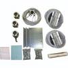
Whisper 50' Guyed Tower Kit (Whi100/Whi200) (does Not Include Pipe & Anchors)
-
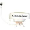
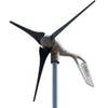
1-AR30-10-12 Air 30 Wind Generator 12VDC
-
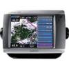
GPSMAP 5008 - Marine GPS receiver - 8.4" color - 640 x 480
-
5" GPS CHARTPLOTTER/FF W/MAPS