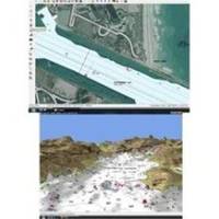
FUGMAR-4 Marine 4 PC Navigation Software v4.5 - Upgradable to 5
Model: FUGMAR-4 Brand: Fugawi
With Fugawi Marine ENC you can navigate using many types of vector and raster charts, including: - Navionics Platinum+, Platinum, Gold+, Gold, Silver, Fish’N’Chip and Hot - Maps charts - Navionics Multi Card Reader no longer required for Navionics Plug-and-Play chips sold after April 2010 - simply plug in the Navionics chip to any generic card reader, internet-activate and copy the charts to your hard drive - Navionics Gold, Fish’N’Chip or Hot - Maps via direct download from Fugawi X-Traverse - S-57 format charts such as NOAA ENC and S-63 Encrypted ENC charts - BSB charts such as NOAA RNC, Canadian Hydrographic, NV.Digital charts, Topographic maps, your own scanned paper maps, and for boaters in the USA, a wide variety of charts are available free of charge - Hilton’s Realtime Navigator charts are available via the X-Traverse Data Link. - Free X-Traverse Account - Fugawi Marine ENC supports select online maps and charts from Fugawi X-Traverse. Fugawi comes with a free 1-year subscription to an X-Traverse Data Plan and detailed topo maps of Canada or USA.Also enjoy the seamless integration with optional Path - Away GPS Software for i - OS, Android, Nokia Symbian or Windows Mobile devices. - Internet Activation of Navionics Charts - Downloadable Navionics Charts - Navionics Gold, Hot - Maps Premium and Fish-N-chip charts may now be purchased online from Fugawi X-Traverse for direct download . - German Topo Maps - Added support for online German Topo Maps via direct download from Fugawi X-Traverse - Furuno Plotters Support - Data card transfer of waypoints and routes with Furuno NAVnet VX2 plotters
Product Specification
-
Universal Product Identifiers
Part Numbers: 44618, DEF-800114, FUGMAR-4GTIN: 00628801005019
Related Products
-
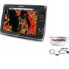
Package(e125 with aus, NZ, S. America, Asia Chart, 4KW 18 Inch Digital Radome & Radar Cable)
-
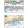
North Shore Long Island Sound, New Rochelle, New York to Norwalk, Connecticut Nautical Marine Charts, Large Print - Waterproof Charts
-
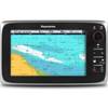
C97 9" Display w/ Sounder and US Coastal Charts
-
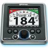
GSC Autopilot No Rudder Feed Back or Drive 700048-1
-
UM415 Oceanus D Marine Radio (White)
-
Series 22 Navigation Lights Deck Mount, Red, 1/4" x 1/8"
-
25ft 24AWG Cat6 550mhz UTP Ethernet Bare Copper Network Cable - Red
-
30 Amp 35' Cord Set - Yellow - 125V
-
6ft USB 2.0 A Male to A Female Extension 28/24AWG Cable (Gold Plated)
-
BNC-Cp/Gs-01 Connector for Rg-58Au Cable
-
E62186-IN - A50D 5 Combo, Inland Maps, Int GPS
-
Tram 1655 8-ft Marine GPS Antenna