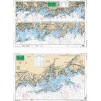
North Shore Long Island Sound, New Rochelle, New York to Norwalk, Connecticut Nautical Marine Charts, Large Print - Waterproof Charts
SOUND- NEW ROCHELLE, NY TO NORWALK CONN.- LARGE PRINTExcellent detailed coverage of the coastal islands and harbors from New Rochelle and Mamaroneck east thru Greenwich, Stamford and Norwalk. Includes the Norwalk Islands. GPS/Loran Waypoints make it easy to set up your unit. A combination of 2 NOAA Charts; 12368 and 12367. « less
Product Specification
-
Universal Product Identifiers
Part Number: 26E
Related Products
-
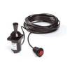
Autopilot Joystick Kit 54500060
-
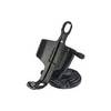
Marine Mount - GPS receiver mount bracket
-
CH270BB/324 180 kHz Black Box Searchlight Sonar System. Includes 350mm Travel Hoist and Operates at 24 and 32VDC
-
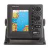
1734C NavNet vx2 Radar System
-
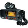
UM415BK Oceanus D Marine Radio (Black)
-
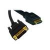
Video cable - Male 19 pin HDMI Type A to M 18 pin digital DVI (Single-Link)
-
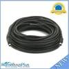
595 50ft S-Video Svideo M/F Extension Cable
-
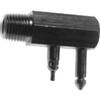
Quicksilver 802182A 1 Connector Pnla
-
CA50B-6B 50kHz Rbr Coat F/ 1kW Units
-
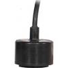
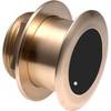
B175-12-L Broadband CHIRP, No CONNECTOR, Depth & Temperature Thru-Hull Tilted
-
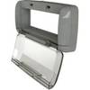
Electronics Corp Univ Splash Guard Grey SG4
-
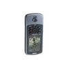
GPSMAP 76 - Marine, hiking GPS receiver - Monochrome - 240 x 180