CFHMPTE6 HotMaps Platinum Multi-Dimensional 3D Lake Maps
Model: CFHMPTE6 Brand: Navionics
HotMaps Platinum Multi-Dimensional Lake Maps - with 1000 of Navionics exclusive high-definition lake maps to 1' contours featuring 3D bottom view, top-down photo/map overlay and panoramic lake pictures. FREE Fish'N Chip high-definition fishing detail for US Great Lakes waters now included in HotMaps Platinum Canada, North and East regions. Plus, over 15,000 additional lakes with underwater structure, improved accuracy, major roads, county lines and more. « less
Product Specification
-
Universal Product Identifiers
Part Numbers: 37632, CF-HMPT-E6, cw-37632, DEF-257887-CFEA6GTIN: 00821245135704
Related Products
-
Commander P2 Mono Display, SSRC1 Rate Gyro Compass & Rotary Feedback 10110031
-
700 Series 777c2 CHO - Fishfinder - optional transducer - dual-beam
-
RS-C208 Furuno FP Format - Barents Sea West Fishing
-
566 Atlantis White Waterproof Hand-Held VHF Marine Radio
-
250ft 16AWG CL2 Rated 4-Conductor Loud Speaker Cable (for
-
25ft RG6 (18AWG) 75OHM, Quad Shield, CL2 Coaxial Cable with F Type Connector - White
-
6ft 32AWG Mini DisplayPort Cable - White
-
Cable Tie 4 Inch 18LBS, 100pcs/Pack - Blue
-
Cat6a Ethernet Cable | 35ft | Black | Network | 10 Gigabit
-
Flush Mount Scupper Adapters, Flush Mount Scupper Adapter Black th
-
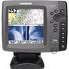
700 Series 798ci SI Combo NVB - Marine Chartplotter - 5" color - 640 x 640
-
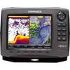
42985 HDS-8 Gen2 Insight USA w/o XD