Cdr10 Digital Chart Kit Pr and US VI
Model: Cdr10 Brand: Maptech
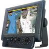
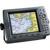
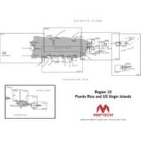
Digital Chart Kit Puerto Rico and US Virgin Islands Contains all NOAA Charts in the title area, Coastal Topo Maps, Selected Navigation Photos, Aerial Pictures, Tides, Light Lists, Coast Pilot, Facilities are not included, Chart Navigator. The charts are BSB4 format-make sure your software is compatible. Digital ChartKit Digital ChartKit has all the software you need to get started in PC navigation. Each region includes GPS navigation software and charts on CD-ROM. Plan Before You Go Digital ChartKits include Offshore Navigator GPS planning and chartplotting software. Route planning is as simple as clicking a mouse. Click, and you've put the first waypoint on the chart. Click again and you're creating a route. It's that easy. Print Print route plans, tide and current graphs, and chart packets on standard home or office printers. GPS Ready Digital ChartKits « less
Product Specification
-
Universal Product Identifiers
Part Numbers: 32517, CDR10, cw-32517GTIN: 00608014703094
Related Products
-
AP2803 Autopilot AP28,AC12,RC42,RF300,RPU80
-
Radar 5008 Package with GMR18 4KW Radome
-
Ocean Chart Lamp, Small
-
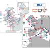
Max IN-M201 W66 Eastern India and Maldives-MAX
-
Max EW-M040 L30 English Channel Eastern-MAX
-
3520-7 LED Red Green, Deck Mount Navigation Light
-
MFDBB NavNet 3D Black Box Multi Function Display Processor
-
EC04230 Yellow Butt Connector 12-10
-
Wiring Device-Kellems Hbl60cm19 Plug,marine Closure 3d946
-
Air Breeze 1-ARBM-15-48 Marine Wind Generator 48VDC
-
GPSMAP 2210 - Marine GPS receiver
-
408950-1 Fishfinder 598ci HD Si Combo