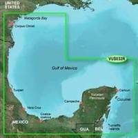
BlueChart g2 Vision - Southern Gulf of Mexico - Maps
Model: Brand: Garmin
BlueChart g2 Vision offers the same rich detailed charting of BlueChart g2 to help you get the most out of your unit. In addition, g2 Vision features a growing database of high-resolution satellite imagery, above and below the water 3D perspective, auto guidance technology, aerial photographs for real world reference and coastal roads with points of interest. This product features detailed coverage of the Gulf of Mexico from Matagorda Bay to Belize City, including Corpus Christi, TX, Veracruz, Mex., the Bay of Campeche, Cancun, Mex., and Cozumel, Mex. « less
Product Specification
-
General
Product Type: MapsDistribution Media: SD Memory CardFirst Seen On Google Shopping: May 2007 -
Compatibility Information
Designed For: Garmin GPSMAP 4008, 4012, 420, 4208, 420s, 4212, 430, 430s, 430sx, 430x, 440, 440s, 440sx, 440x, 450, 5008, 5012, 520, 5208, 520s, 5212, 525, 525s, 530, 530s, 535, 535s, 540, 540s, 545, 545s, 550, 550s, 555, 555s -
Universal Product Identifiers
Part Numbers: 010-C0733-00, Southern Gulf of MexicoGTIN: 00753759069131, 00781573940213
Related Products
-
NAVPILOT 720 Autopilot for Inboard without Pumpset
-
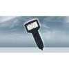
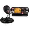
Marine MRF75 VHF Radio / LCD
-
2777.91 FBRS 2777 Battery Replacement Service
-
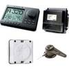
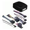
AP2804 Autopilot System AP28,AC42,RC42,RF300,RPU160
-
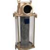
3" Water Strainer
-
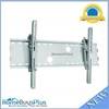
Adjustable Tilting Wall Mount Bracket for LCD LED Plasma (Max 165Lbs, 30~63inch) - Silver (No Logo)
-
Axxess - AX-FMUSBEXTCB - Male to Female 3.5mm Cable
-
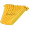
Hook & Loop Fastening Cable Ties 6inch, 10pcs/Pack - Yellow
-
2103 Hose Power Trim MERC. 32-86036
-
80A Adapter-15/20A Str-20A Lockin
-
Marine Systems Inc HA5P Hose Adapter 5 in. duct. Ebo7/8
-
DM-LTB-100 Light Bar for Dual Mounts