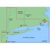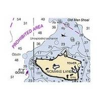
Hecate Strait-Etollin Island Chart
Dept. of Commerce - 17420; NOAA nautical charts Encompasses the southern part of Southeast Alaska Note: Ensure that your charts are kept current to reflect changes to that area
Product Specification
-
Universal Product Identifiers
Part Number: 17420
Related Products
-
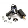
000-0046-26 SB-9BL Switch Box 2 Transducer-1 Sonar
-
XN13A/6 - 6 Foot Open Array Antenna
-
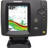
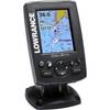
500 Series 586c - Fishfinder - included transducer : XNT-9-20-T - dual-beam
-
PAPR03; Region 3 Paper Chart Kit
-
MapSource BlueChart - New York - Maps
-
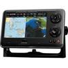
000-10489-001 - Elite-4M Gold Chartplotter, w/Navionics Bundle Lowrance
-
PH6624 Female Conn Phone
-
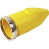
F50Cvl-Sy 50 Amp Connector (F) Cover Yel
-
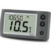
E22039 ST40 Bidata Display (without Transducer)
-
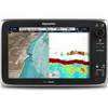
C125 Multifunction Display w/US Coastal Charts Map
-
1ft 24AWG Cat5e 350MHz UTP Bare Copper Ethernet Network Cable - Pink
-
CPN700i 7 Networking GPS w/WiFi Preloaded Map