BlueChart g2 Vision - North Slope Alaska - Maps
Model: Brand: Garmin
BlueChart g2 Vision offers the same rich detailed charting of BlueChart g2 to help you get the most out of your unit. In addition, g2 Vision features a growing database of high-resolution satellite imagery, above and below the water 3D perspective, auto guidance technology, aerial photographs for real world reference and coastal roads with points of interest. This product features detailed coverage of the northern coast of Alaska from Point Hope to the United States/Canadian border including Point Barrow, Kaktovik, and Peard Bay. « less
Product Specification
-
General
Product Type: MapsDistribution Media: SD Memory CardFirst Seen On Google Shopping: May 2007 -
Compatibility Information
Designed For: Garmin GPSMAP 4008, 4012, 420, 4208, 420s, 4212, 430, 430s, 430sx, 430x, 440, 440s, 440sx, 440x, 450, 5008, 5012, 520, 5208, 520s, 5212, 525, 525s, 530, 530s, 535, 535s, 540, 540s, 545, 545s, 550, 550s, 555, 555s -
Universal Product Identifiers
Part Numbers: 010-C0736-00, North Slope AlaskaGTIN: 00753759069162
Related Products
-
AP50 Autopilot System Pack 1 with AP50, J50 (12 Amps), Rudder Feedback RF300 & RC25 Compass
-
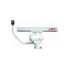
6 Inch Power Radar Mount for 4' JRC Open Array PMA-6JO-8L ( PMA-57-M1 + ADA-R1)
-
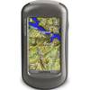
Oregon 450T Handheld GPS with Topo US Maps c38059
-
400540-1 Halogen Chart Light, Large, Brass 20W
-
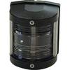
Classic Stern Light Black, Series 25 25500-7
-
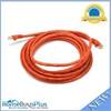
14ft 24AWG Cat6 550mhz UTP Ethernet Bare Copper Network Cable - Orange
-
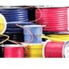
10/3 30 Amp Cable, 250' Spool, Yellow 14179
-
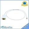
3ft 32AWG Mini DisplayPort | Thunderbolt to VGA Cable - White
-
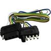
TC51000 Pole Flat Connector
-
Spark Plug wire, r, 84-857124A 1
-
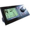
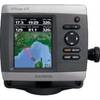
GPSMAP 421 - Marine Chartplotter - 4" color - 240 x 320
-
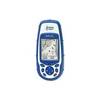
Meridian - Marine, hiking GPS receiver - Monochrome - 120 x 160