BlueChart g2 Vision - Mobile to Lake Charles - Maps
Model: Brand: Garmin
BlueChart g2 Vision offers the same rich detailed charting of BlueChart g2 to help you get the most out of your unit. In addition, g2 Vision features a growing database of high-resolution satellite imagery, above and below the water 3D perspective, auto guidance technology, aerial photographs for real world reference and coastal roads with points of interest. This product features Mobile, AL through Calcasieu Lake, LA, including New Orleans, the Mississippi River Delta, Lake Ponchartrain and Lake Maurepas, over to Vermilion Bay. « less
Product Specification
-
General
Product Type: MapsDistribution Media: SD Memory CardFirst Seen On Google Shopping: May 2007 -
Compatibility Information
Designed For: Garmin GPSMAP 4008, 4012, 420, 4208, 420s, 4212, 430, 430s, 430sx, 430x, 440, 440s, 440sx, 440x, 450, 5008, 5012, 520, 5208, 520s, 5212, 525, 525s, 530, 530s, 535, 535s, 540, 540s, 545, 545s, 550, 550s, 555, 555s -
Universal Product Identifiers
Part Numbers: 010-C0714-00, Mobile to Lake CharlesGTIN: 00753759068943
Related Products
-
St6001 S1G Hydraulic Outboard sys E12122
-
000-10802-001 LSS-2 StructureScan HD Sonar Imaging TM Transdu
-
HDS 8, 8m, 10, 10m, GPS Chartplotter/Sonar [DVD]
-
Audio MR650 2 Way Marine Speaker White c33065
-
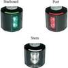
Series 43 White LED Navigation Light Stern
-
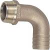
3" Pipe to Hose Adapter-90 Degree
-
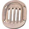
6-1/4 x 4-1/2 Scoop Strainer
-
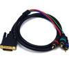
3.25ft DVI-I to 3 RCA Component Video Cable (DVI-I - 3-rca)
-
Cat6a Ethernet Cable | 15ft | White | Network | 10 Gigabit
-
Ethernet Category 6 Enhanced RJ45 Network Patch Cable - 14' Black.
-
Inc ETS0131472 Computer Hardware
-
010-00924-07 Montana Marine Bundle - Mount, AC Charger, USB, Ba