BlueChart g2 Vision - Lake Erie - Lake St. Clair - Maps
Model: Brand: Garmin
BlueChart g2 Vision offers the same rich detailed charting of BlueChart g2 to help you get the most out of your unit. In addition, g2 Vision features a growing database of high-resolution satellite imagery, above and below the water 3D perspective, auto guidance technology, aerial photographs for real world reference and coastal roads with points of interest. This product features coverage of both the U.S. and Canadian sides of the southern portion of Lake Huron. Detailed coverage of the St. Clair River, Lake St. Clair, Detroit River, and the U.S. portion of Lake Erie through Buffalo. Also includes coverage of the Canadian portion of Lake Erie and the western side of Lake Ontario, including detailed coverage of Long Point Bay, Welland Canal, the Niagara River, and Toronto. « less
Product Specification
-
General
Product Type: MapsDistribution Media: SD Memory CardFirst Seen On Google Shopping: May 2007 -
Compatibility Information
Designed For: Garmin GPSMAP 4008, 4012, 420, 4208, 420s, 4212, 430, 430s, 430sx, 430x, 440, 440s, 440sx, 440x, 450, 5008, 5012, 520, 5208, 520s, 5212, 525, 525s, 530, 530s, 535, 535s, 540, 540s, 545, 545s, 550, 550s, 555, 555s -
Universal Product Identifiers
Part Numbers: 010-C0719-00, Lake Erie - Lake St. ClairGTIN: 00753759068998
Related Products
-
Package(c127 with aus, NZ, S. America, Asia Chart, 4KW 24 Inch Digital Radome & Radar Cable)
-
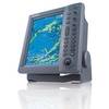
FR8062 12.1 Inch 6KW, 72 nm, 12.1 Color Display Radar 4' Open Array Antenna fr80624
-
MDS-9 4KW 24 Inch Dome Black Box Radar with 10 Meter Cable wmds9
-
1032 LLB-1 Battery (1032)
-
POD-4S 4 Person Life RAFT- Soft Valise
-
0493010PLB 2-1/2" IPS Intake Strainer Bronze
-
Bridge Navigational Watch Alarm System BR500
-
100ft 24AWG Cat6 550mhz UTP Ethernet Bare Copper Network Cable - Green
-
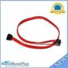
0.5meter SATA Serial ATA Cable (90 Degree - Right Angle)
-
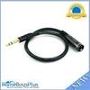
1.5ft Premier Series XLR Male to 1/4inch TRS Male 16AWG Cable (Gold Plated)
-
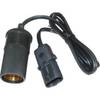
RA-2 12 Volt Female Cigarette Lighter Adapter
-
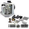
115V Seawater and Air Distribution Kit for 12,000 BTU Units