BlueChart g2 Vision - Italy, Adriatic Sea - Maps
Model: Brand: Garmin
BlueChart g2 Vision offers the same rich detailed charting of BlueChart g2 to help you get the most out of your unit. In addition, g2 Vision features a growing database of high-resolution satellite imagery, above and below the water 3D perspective, auto guidance technology, aerial photographs for real world reference and coastal roads with points of interest. This product features coverage of all of the Adriatic Sea and extends south to Siracusa, Sicilia and Gulf of Arcadia, Greece. Includes detailed coverage of Lago Maggiore, Lago d'Iseo, and Lago d'Garda in Italy. « less
Product Specification
-
General
Product Type: MapsDistribution Media: SD Memory CardFirst Seen On Google Shopping: June 2007 -
Universal Product Identifiers
Part Numbers: 010-C0772-00, Italy, Adriatic SeaGTIN: 00753759069520 -
Compatibility Information
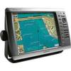
Designed For: Garmin GPSMAP 4008, 4012, 420, 4208, 420s, 4212, 430, 430s, 430sx, 430x, 440, 440s, 440sx, 440x, 450, 5008, 5012, 520, 5208, 520s, 5212, 525, 525s, 530, 530s, 535, 535s, 540, 540s, 545, 545s, 550, 550s, 555, 555s
Related Products
-
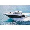
MA7500 Compact Box Marine Speaker, 100 Watts (Pair) c13809
-
010-C0752-10 Bluechart G2 HAF452SKnysna Sa to Beira MZ Data
-
GA-0100070520 - GHP 10V Autopilot Corepack (Volvo Ips)
-
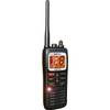
DE6141 Floating Marine Handheld vhfradio
-
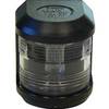
Series 41 Masthead Navigation Light for Bulkhead Mounting
-
4KW 24in Radome No Cable E52080
-
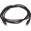
644 6ft 3.5mm Stereo Plug/Plug M/M Cable - Black
-
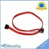
0.5meter SATA Serial ATA Cable (90 Degree - Right Angle)
-
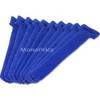
Hook & Loop Fastening Cable Ties 6inch, 10pcs/Pack - Blue
-
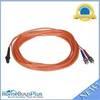
2640 Fiber Optic Patch cable,mtrj (m)/st,10m
-
/ Quicksilver 22-85822T Speedo Tube Connector
-
GPSMAP 4212 - Marine Chartplotter - 12.1" color - 1024 x 768