BlueChart g2 Vision - Hawaiian Is. - Mariana Is. - Maps
Model: Brand: Garmin
BlueChart g2 Vision offers the same rich detailed charting of BlueChart g2 to help you get the most out of your unit. In addition, g2 Vision features a growing database of high-resolution satellite imagery, above and below the water 3D perspective, auto guidance technology, aerial photographs for real world reference and coastal roads with points of interest. This product features coverage of the Pacific Ocean from the Hawaiian to Mariana Islands. Includes coverage of Guam, Midway, and Johnston Atoll. General coverage of Palmyra Atoll and the Marshall Islands also included. « less
Product Specification
-
General
Product Type: MapsDistribution Media: SD Memory CardFirst Seen On Google Shopping: May 2007 -
Compatibility Information
Designed For: Garmin GPSMAP 4008, 4012, 420, 4208, 420s, 4212, 430, 430s, 430sx, 430x, 440, 440s, 440sx, 440x, 450, 5008, 5012, 520, 5208, 520s, 5212, 525, 525s, 530, 530s, 535, 535s, 540, 540s, 545, 545s, 550, 550s, 555, 555s -
Universal Product Identifiers
Part Numbers: 010-C0728-00, Hawaiian Is. - Mariana Is.GTIN: 00753759069087
Related Products
-
/ Quicksilver 22-43828T Connector
-
HDS-10 No Transducer - 140-41
-
Marine ILPB2001250 Munich LED Reading Chart Marine Light
-
Nauticomp Signature 15 Inch Sunlight Marine Display, Flush Mount
-
ACR2882 ACR AquaLink PLB350B
-
AP35 Autopilot System AP35, J3000X, RF300 No Heading Sensor
-
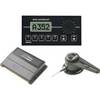
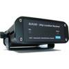
AIS Dual Channel Synthesised Rcvr SLR-200
-
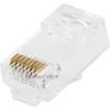
GC7267 Stranded Cat6 RJ45 Plug (100-Pack)
-
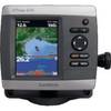
GPSMAP 421s - Marine Chartplotter - 4" color - 240 x 320
-
Whisper Whi-200 High Voltage Controller (220V)
-
43311 Elite-4 Gold Combo w/ 83/200khz Xdcr
-
GP32 4.5 Inch Monochrome LCD WAAS/GPS Receiver & Navigator