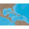
BlueChart g2 - The Nordics - Maps
Model: Brand: Garmin
BlueChart g2 features crisp labeling and an overall smoother presentation on your chartplotter display. In addition to the basic charts, tidal stations, currents, depth contours, IALA symbols and included fishing charts, BlueChart g2 offers improved transitioning between zoom levels and more seamless continuity across chart boundaries. BlueChart g2 also adds safety shading which allows the user to enable contour shading for all depth contours shallower than the user-defined safe depth. The fishing charts are designed to emphasize bathymetric contours with less visual clutter on the display. « less
Product Specification
-
General
Product Type: MapsDistribution Media: SD Memory CardFirst Seen On Google Shopping: November 2011 -
Universal Product Identifiers
Part Numbers: 010-C1021-20, The NordicsGTIN: 00753759095505
Related Products
-
GMR 406 6 ft Open Array Antenna Only
-
How to read a nautical chart: a complete guide to the symbols, abbreviations, and data displayed on nautical charts [Book]
-
BlueChart g2 Vision - Hawaiian Is. - Mariana Is. - Maps
-
NA-C401 C-Card Format - St. Lucie Inlet LK Pontch
-
Marine World Chart of Nicolo de Canerio Januensis [Book]
-
M72 Handheld VHF Radio 220V #IC-M72 220V
-
000-10345-001 - NSE12 Navigation Pack
-
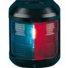
Navigation Light for Bulk Head Mounting , Stern
-
Navigation Light for Bulk Head mounting, Port
-
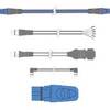
3M Stripped End Spur Cable for SeaTalk NG
-
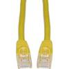
Cat6a Ethernet Cable | 1ft | Yellow | Network | 10 Gigabit
-
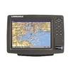
GlobalMap 8200C - Marine GPS receiver - 8.4" color - 600 x 800