8265; Map-Lake Camanche/Folsom Lake
Model: 8265 Brand: Fish-n-Map
FISH-N-MAP UNDERWATER TOPOGRAPHY MAPSMade of waterproof, tear resistant plastic. Features include: underwater depth contours, fish locations, latitude and longitude for GPS, multiple freshwater lakes on one map, boat ramps, recreational facilities and much more.
Product Specification
-
Universal Product Identifiers
Part Numbers: 235310, 8265GTIN: 00761428082657
Related Products
-
BlueChart g2 Vision - North Slope Alaska - Maps
-
Max AU-M222 W63 New Zealand Chatham-MAX
-
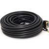
Cat6a Ethernet Cable | 5ft | Orange | Network | 10 Gigabit
-
T70080 P70, X-10 Type 1 Linear Autopilot Package f/Sailboats
-
409030-1 386ci Combo
-
75ft 24AWG Cat6 550mhz UTP Ethernet Bare Copper Network Cable - Yellow
-
Serial cable - (DB-9) - M - (DB-9) - F - 50 ft - PC
-
560 VGA + 3.5mm Stereo Audio Male to Male Cable 50 ft. CL2
-
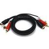
2187 3ft S-Video & 3ft RCA Audio Cable - Molded
-
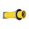
Wiring Device-Kellems M4100P12 Plug, Pin/Sleeve, 100 A
-
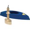
B45-DT-8 600W Thru-Hull Transducer Furuno 8-Pin Fuji Connector
-
FCF16000 Kit with AC, Seawater & Ducting - 115V FCFK022A