How to read a nautical chart: a complete guide to the symbols, abbreviations, and data displayed on nautical charts [Book]
The best handbook on chart usage, from one of the most trusted names in boatingIn 2000, the U.S. government ceased publication of Chart No. 1, the invaluable little book that generations of mariners have consulted to make sense of the complex system of signs, symbols, and graphic elements used in nautical charts. Now Chart No. 1 is not just reborn but expanded and improved in How to Read a Nautical Chart. The demand for a book like this has never been greater.Arranged and edited by Nigel Calder, one of today's most respected boating authors, --and containing four-color illustrations throughout,-- How to Read a Nautical Chart presents a number of original features that help readers make optimum use of the data found in Chart No. 1, including a more intuitive format, crucial background information, international chart symbol equivalents, electronic chart symbology, and thorough explanations of the practical aspects of nautical chart reading. « less
Product Specification
-
Authors: Nigel CalderPages: 237Format: paperbackPublication Date: 2003Key Terms: geoid, chart datum, drying height, IALA, sectored lights, NOAA, Chesapeake Bay, World Geodetic System, buoy, ellipsoid, hydrographic offices, Nautical Chart, Notices to Mariners, RACON, British Admiralty, traffic separation scheme, Retroreflector, Mercator chart, numbers, imperial units
-
Universal Product Identifiers
ISBN: 0071376151GTIN: 09780071376150
Related Products
-
AP35-8 Autopilot with AP35, Rudder Feedback RF300, J300X-40(20A peak) and RPU300, 24V Drive Unit (for Hydraulic Steering) sap358
-
E32153 Raystar 130 GPS Antenna
-
958c HD Di Down Imaging GPS Fishfinder 408710-1 c46192
-
BlueChart g2 Vision - Southern Gulf of Mexico - Maps
-
Max AU-M005 W60 Australia-MAX
-
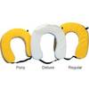
Cal June 1020 Horseshoe Buoy
-
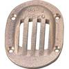
6-1/4 x 4-1/2 Scoop Strainer
-
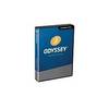
TimeZero Odyssey Navigation Software
-
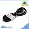
3ft 18AWG Power Cord Cable w/ 3 Conductor PC Power Connector Socket (C13/5-15P) - Black
-
/ Quicksilver 807097T Connector
-
M72 Handheld VHF 72
-
010-00737-00 GWS 10 Marine Wind Sensor