30128 Max - U.S. Gulf Coast and Inland Rivers - C-Card
Model: 30128 Brand: C-Map
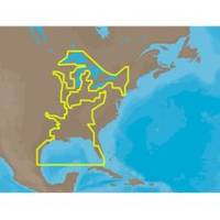
NA-M023 => Gulf of Mexico, Great Lakes and Rivers Coverage of the Gulf states, starting from Boca Raton, FL, down to Key West, FL, then back up and around the Gulf to Brownsville, TX. Also includes coverage of all the Great Lakes: Erie, Superior, Ontario, Huron and Michigan. Coverage of the Great Lakes also includes Fox River and Lake Winnebago, Lake St. Clair and the Trent-Severn Waterway. River coverage includes the Mississippi River, Ohio River, Illinois River, Arkansas River, Red River, Ouachita River, Tennessee River, Cumberland River, Tenn-Tom Waterway and the Black Warrior River. Other smaller rivers are also included: Green River, KY, Kanawha River, WV, Allegheny and Monongahela Rivers, PA and Kankakee River, IL. Additional coverage of the Hudson River, including Lake Champlain, down to New York City, the Erie Barge Canal and partial coverage of the St. Lawrence River up to Montreal. « less
Product Specification
-
Universal Product Identifiers
Part Numbers: 30128, NA-M023, NA-M023.00, NA-M023C-CARDGTIN: 000000165837, 00686074002739
Related Products
-
AP35-2 Autopilot with AP35, J300X, Rudder Feedback RF300
-
Radar 5215 Package with GMR18 4KW Radome
-
DVD Raymarine E Series E80 E120 Radar N7802DVD
-
500 Series 525 - Fishfinder - included transducer : XNT-9-20-T - single-beam
-
Chart Weight, Compass, Brass
-
Lvr-250 DSC VHF Fixed-Mount Marine Radio
-
Navigational Systems and Simulators: Marine Navigation and Safety of Sea Transportation [Book]
-
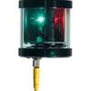
Orca Green Marine LED Tri-Color Anchor / Strobe Navigation Light
-
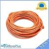
75ft 24AWG Cat6 550mhz UTP Ethernet Bare Copper Network Cable - Orange
-
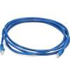
MP 134 24AWG Cat5e 350MHz UTP Ethernet Cable, 7 Foot - Blue
-
6ft USB 2.0 A Male to Mini-B 5pin Male 28/24AWG Cable w/ Ferrite Core (Gold Plated)
-
10ft 24AWG Cat5e 350MHz UTP Bare Copper Ethernet Network Cable - Gray