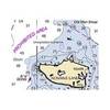
010-C0761-10 Bluechart G2 HEU002RDover to Amsterdam & England
Model: 010-C0761-10 Brand: Garmin
British coast: from Scarborough Harbour to Newhaven, including River Thames to London. Continental coast: from Amsterdam to Fecamp See your surroundings more clearly with BlueChart g2 data. With BlueChart g2, you'll get detailed marine cartography that provides convenient viewing of nautical content. BlueChart g2 allows you to see your vessel's precise, on-chart position in relation to naviads, coastal features, anchorages, obstructions, waterways, restricted areas and more. You will also have access to detailed mapping capabilities that include Safety Shading , Fishing Charts , smooth data transition between zoom levels, harmonious transition across chart borders, and reduction of chart discontinuities. « less
Product Specification
-
Universal Product Identifiers
Part Numbers: 010-C0761-10, 10804771, 35595GTIN: 00753759091453
Related Products
-
AIT1000 Class B Transponder w/GPS Antenna Incl
-
RSB0070-059 24 rpm Gearbox with 6.0 KW Transceiver
-
Package(C120W, DSM300G Sounder, 4KW 18 Inch Digital Radome & Radar Cable)
-
700 Series 798c SI Combo NVB - Fishfinder - included transducer : XNT-9-SI-180-T - dual-beam
-
NOAA Dixon Entrance-Cape St. Elias
-
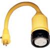
Shore Power Cable 6/4 White Per ft
-
35ft 18AWG CL2 Premium 5-rca Component Video/audio Coaxial Cable (RG-6/U) - Black
-
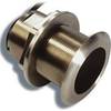
B260-10F 1kW Thru-Hull Transducer Furuno 10-Pin Connector
-
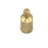
B60-12 Tiled Element Ducer W/10P Pigtail Connector
-
Marine Products Terminal, Spark Plug Wire 9-28122
-
115A Adapter 50A 125V Locking
-
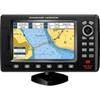
7" GPS Chartplotter W/MAPS