010-C0760-10 Bluechart G2 HEU001REnglish Channel Data Card
Model: 010-C0760-10 Brand: Garmin
British coast: covers from Felixstowe to the Isles of Scilly, including Dover, The Solent, and the Isle of Wight. Also covers the River Thames from Twickenham to the North Sea. French coast: covers from Dunkerque to L'Aber Wrac'h, including Rouen and the Channel Islands. See your surroundings more clearly with BlueChart g2 data. With BlueChart g2, you'll get detailed marine cartography that provides convenient viewing of nautical content. BlueChart g2 allows you to see your vessel's precise, on-chart position in relation to naviads, coastal features, anchorages, obstructions, waterways, restricted areas and more. You will also have access to detailed mapping capabilities that include Safety Shading , Fishing Charts , smooth data transition between zoom levels, harmonious transition across chart borders, and reduction of chart discontinuities. « less
Product Specification
-
Universal Product Identifiers
Part Numbers: 010-C0760-10, 10804748, 35593GTIN: 00753759091439
Related Products
-
AIT1000 Class B Transponder w/GPS Antenna Incl
-
MSD/3XG Gold Central & South America - SD/Micro SD
-
CFHMPTN6 HotMaps Platinum Multi-Dimensional 3D Lake Maps
-
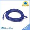
30ft 24AWG Cat5e 350MHz UTP Bare Copper Ethernet Network Cable - Blue
-
25ft 24AWG Cat5e 350MHz UTP Bare Copper Ethernet Network Cable - Purple
-
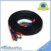
10ft 22AWG 5-rca Component Video/audio Coaxial Cable (RG-59/U) - Black
-
50ft Premium Optical Toslink Cable w/ Metal Fancy Connector
-
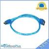
3939 18inch SATA 6Gbps Cable - UV Blue
-
50M1 50 Amp - 125VAC Male Plug
-
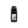
GPSMAP 78sc - Marine, hiking GPS receiver - 2.6" color - 160 x 240
-
Ltb Top - Universal Box Top for All Round, Masthead & Stern Lights LTB-BOX
-
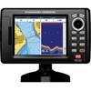
5" GPS CHARTPLOTTER/FF W/MAPS