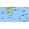
CFHMPTN6 HotMaps Platinum Multi-Dimensional 3D Lake Maps
Model: CFHMPTN6 Brand: Navionics
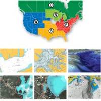
HotMaps Platinum offers 300 of Navionics exclusive high-definition lake maps featuring 1 contours, 3D bottom view, top-down photo/map overlay, and panoramic lake pictures. HotMaps Platinum series also offers 14,000 additional lakes with underwater structure, improved accuracy, major roads, county lines and more. HotMaps Platinum is compatible with most new Humminbird, Lowrance, Northstar, and Raymarine chartplotters. Please call for chartplotter compatibility. « less
Product Specification
-
Universal Product Identifiers
Part Numbers: 11094208, 37630, CF-HMPT-N6, DEF-257887-CFNO6GTIN: 00821245115706
Related Products
-
FAP7002 Processor for 700 Series Autopilot
-
Onix350 HH GPS w/ Georeferenced Satellite Photos
-
JMA-5322-9 Radar 96 NM with 9' Open Array & 19 Inch LCD Monitor
-
Max Electronic Chart - South America - Costa Rica to Chile & The Falklands, Wide Coverage SA-M500
-
MapSource BlueChart - Southeast Florida - Maps
-
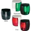
Marine Naviled Pro Starboard Navigation Light 12039749
-
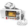
UM415 Oceanus D Marine Radio (White)
-
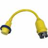
A3050HS 125VAC - 30 Amp -to- 125/250VAC - 50 Amp Straig
-
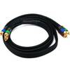
6ft 18AWG CL2 Premium 3-RCA Component Video Coaxial Cable
-
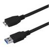
USB 3.0 Micro Cable | 10ft | Type A | Micro Type B | Black
-
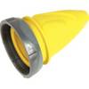
F30Cvl-Sy 30 Amp Connector (F) Cover Yel
-
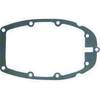
Marine Products Gasket, Adapter Plate 9-60042