010-C0730-10 Bluechart G2 HUS029RSouthern Bahamas Data Card
Model: 010-C0730-10 Brand: Garmin
Featuring data from explorere charts for the Bahamas! Detailed coverage from Eleuthera Island, Bahamas to the Dominican Republic, including the Bahamian islands of Great Exuma, Great Inagua, Mayaguana, and many others. Also includes detailed coverage of the Jamaican, Haitian, and Dominican coasts in their entirety, the easternmost quarter of Cuba, and the Turks and Caicos Islands. See your surroundings more clearly with BlueChart g2 data. With BlueChart g2, you'll get detailed marine cartography that provides convenient viewing of nautical content. BlueChart g2 allows you to see your vessel's precise, on-chart position in relation to naviads, coastal features, anchorages, obstructions, waterways, restricted areas and more. You will also have access to detailed mapping capabilities that include Safety Shading , Fishing Charts , smooth data transition between zoom levels, harmonious transition across chart borders, and reduction of chart discontinuities. « less
Product Specification
-
Universal Product Identifiers
Part Numbers: 010-C0730-10, 10469864, 35560, GAR010C073010GTIN: 00753759089313
Related Products
-
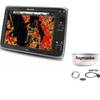
Package(e125 with aus, NZ, S. America, Asia Chart, 4KW 24 Inch Digital Radome & Radar Cable)
-
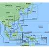
MapSource BlueChart - Hong Kong/South China Sea - Maps
-
2-015 Outdoor US Southeast Chart for Endura Series
-
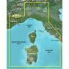
BlueChart g2 Vision - Ligurian Sea, Corsica and Sardinia - Maps
-
Chapman Nautical Chart No. 1: The Essential Guide to Chart Reading and Navigation [Book]
-
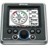
GSC Autopilot with Rudder feedback. No Drive 7000471
-
50PC50 50 Amp - 125VAC 50 Foot Cable Cord Set (Yellow)
-
25ft Premier Series XLR Male to XLR Female 16AWG Cable (Gold Plated) [Microphone & Interconnect]
-
CM8 24V DC Cablemaster 100A Cable
-
HS5 SeaTalk hs Network Switch, A80007 c44691
-
Fixed Mount VHF Marine Radio Whit UN-U*415
-
Memory-Map Adventurer 3500 GPS - Marine -Yellow/Black