Waterproof Chart Kit - South Shore Long Island #WPB0340-02
Model: WPB0340-02 Brand: Maptech
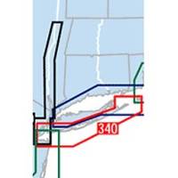
Waterproof Charts w/ Companion CD WPB0340 340: South Shore Long Island NY Harbor's Lower Bay to Montauk and Block Island. 25 chart pages, GPS waypoints, Lat. /Long. grids, pre-plotted courses, ramps, and 340 marine facilities. 12 x 17, scales 1:1,263,000 to 1:26,000. Product Overview These easy-to-use, compact chart books are ideal for Day-Sailors, Fishing Boats, and Trailer Boats. They measure 12 x 17 (24 x 17 when open) and are made of waterproof, tear-resistant synthetic paper that will withstand the elements. GPS Ready New features make Waterproof Chartbooks easy to use with your GPS. Most charts include one-minute lat./long. grids to make vessel positioning a breeze, and major navigation aids are identified with named GPS waypoints. Small and Large-Scale Charts Waterproof Chartbooks include small-scale, wide area charts as well as large-scale, detailed charts of harbors and approaches. « less
Product Specification
-
Universal Product Identifiers
Part Number: WPB0340-02
Related Products
-
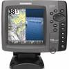
788ci HD Di Combo Down Imaging Combo 39704
-
E102143 CP450C ClearPulse Chirp Sonar
-
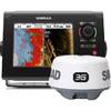
NSS7 Navigation Pack - NSS7 & 3G Radar 000-10629-001
-
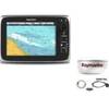
Package(c95 with USA Coastal Chart, 4KW 24 Inch Digital Radome & Radar Cable)
-
4KW HD Digital Pedestal w/VCM/ RAY-E52069E
-
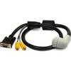
010-11091-00 Marine Audio/Video Cable, Right Angle
-
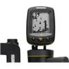
Fishin' Buddy 110 - Fishfinder - included transducer - single-beam
-
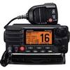
Gx2000sb Two-Way Radio,marine,25 Watts 4lpt1
-
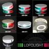
Lopo Light Masthead (3nm)
-
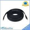
4164 35ft 24AWG CL2 Flat Standard HDMI Cable - Black
-
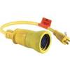
Wiring Device-Kellems Hbl61cm54 Marine Adapter 3d968
-
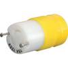
4731CR Female Connector 15A 125V