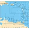
Waterproof Chart Kit - Long Island Sound #WPB0325-03
Model: WPB0325-03 Brand: Maptech
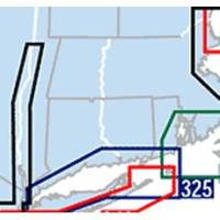
Waterproof Charts w/ Companion CD WPB0325 325: Long Island Sound NEW LAYOUT. 20 MORE PAGES. The entire Sound to Block Island and Point Judith. 10 overview charts and 50-plus harbor insets. 48 pages, 200 GPS waypoints, pre-plotted courses, ramps and 500 marinas. 12 x 17, scales 1:89,000 with insets. Product Overview These easy-to-use, compact chart books are ideal for Day-Sailors, Fishing Boats, and Trailer Boats. They measure 12 x 17 (24 x 17 when open) and are made of waterproof, tear-resistant synthetic paper that will withstand the elements. GPS Ready New features make Waterproof Chartbooks easy to use with your GPS. Most charts include one-minute lat./long. grids to make vessel positioning a breeze, and major navigation aids are identified with named GPS waypoints. Small and Large-Scale Charts Waterproof Chartbooks include small-scale, wide area charts as well as large-scale « less
Product Specification
-
Universal Product Identifiers
Part Number: WPB0325-03
Related Products
-
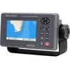
GPS 95CPI GPS Plotter with Internal Antenna c31313
-
000-10421-001 Broadband 4G Radar w/20m Cable
-
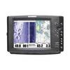
1100 Series 1197c SI Combo NVB - Fishfinder - included transducer : XHS-9-HDSI-180-T - dual-beam
-
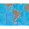
A241 Imray St. Barthelemy Marine Nautical Chart
-
SA-C002 Furuno FP Format - Chile
-
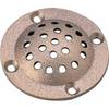
5" Round Bronze Strainer Made in The USA
-
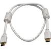
3ft 28AWG High Speed HDMI Cable w/Ferrite cores - White
-
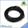
50ft RG6 (18AWG) 75OHM, Quad Shield, CL2 Coaxial Cable with F Type Connector - White
-
25ft 24AWG Cat6 550mhz UTP Ethernet Bare Copper Network 2316
-
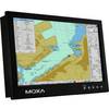
MD-124Y 24 Inches Marine Display with 16:9 Aspect Ratio. Full HD (1920x108
-
Flush Mount Scupper Adapters, Flush Mount Scupper Adapter Black th
-
GPSMAP 4208 Network Bundle Includes GSD22 & Gxm51