The Sea Chart: The Illustrated History of Nautical Maps and Navigational Charts [Book]
The sea chart was one of the key tools by which ships of trade, transport and conquest navigated their course across the oceans. John Blake looks at the history and development of the chart and the related nautical map, in both scientific and aesthetic terms, as a means of safe and accurate seaborne navigation. This handsome work contains 150 color illustrations including the earliest charts of the Mediterranean made by early thirteenth-century Italian merchant adventurers, as well as eighteenth-century charts that became strategic naval and commercial requirements and led to Cook's voyages in the Pacific, the search for the Northwest Passage, and races to the Arctic and Antarctic. « less
Product Specification
-
Authors: John Blake, Lie LiePages: 160Format: paperbackPublication Date: September 1, 2009
-
Universal Product Identifiers
ISBN: 1591147824GTIN: 09781591147824
Related Products
-
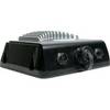
GSD 22 - GPS receiver remote sonar sensor
-
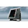
1835 10.4 Inch Color LCD 36 NM Radar with 24 Inch 4KW Dome
-
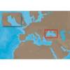
EM-C102 C-Card Format - Black Sea & Marmara
-
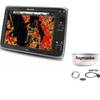
Package(e125 with USA Coastal Chart, 4KW 18 Inch Digital Radome & Radar Cable)
-
Waterproof Chart Kit - Puget Sound #WPB1520-02
-
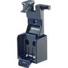
9507 Quickdraw Cat II EPIRB Bracket FITS RLB 36 37
-
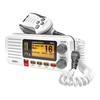
UN-UM415 - Fixed Mount VHF Marine Radio Whit
-
332037 LED Starboard Side Mount White
-
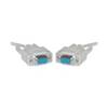
Serial cable - (DB-9) - F - 25 ft - PC
-
Patch cable - CAT 6 - RJ-45 - M - Unshielded twisted pair (UTP) 10 ft - Blue
-
Air Breeze 30 Land Wind Turbine with Built-In Regulator ar30-10
-
Whisper 80' Guyed Tower Kit (Whi100/Whi200) (does Not Include Pipe & Anchors)