Sea Charts of the British Isles: A Voyage of Discovery Around Britain & Ireland's Coastline [Book]
Sea Charts of the British Isles takes the reader on a voyage through the seaports, fishing and commercial harbors, naval bases and dockyards, and sea-side havens that have always supported local life in Britain and contributed to the Isles’ defense. This beautiful collection of charts contains a wealth of information about Britain’s maritime history, as well as the history of charting and surveying. The great names in British chart-making are all included, from Captain Greenvile Collins and Professor Murdoch Mackenzie to Graeme Spence and William Bligh. « less
Product Specification
-
Authors: John Blake, Lie, John Blake (Lieutenant Commander.)Pages: 128Format: hardbackPublication Date: November 19, 2005Key Terms: British Crown Copyright, Trinity House, Royal Navy, British Library, Scotland, British Isles, Admiralty, River Tyne, portolan charts, compass rose, Portland Bill, Pembrokeshire, South Ronaldsay, Isle of Wight, Lowestoft, River Thames, King's Lynn, Pentland Firth, Firth of Clyde, English Channel
-
Universal Product Identifiers
ISBN: 1844860248GTIN: 09781844860241
Related Products
-
GPS Backtrack Marine Locator Blue Clam Pack MODEL: 360070C
-
Radar 5015 Package with GMR24HD 4KW Radome & GSD22 Sounder
-
EM-C950 Furuno FP Format - Marina Di Carrara - Marina Di Tarq
-
BlueChart g2 Vision - South Maine - Maps
-
E15026 Life Tag Wireless Man Overboard System (Extra Tags)
-
Cat6a Ethernet Cable | 2ft | Orange | Network | 10 Gigabit
-
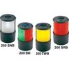
Base Mount White Masthead Navigation Lights Double Stack
-
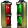
Double Lens, Side Navigation Lights, 120V Volts, 1164 Series, Red
-
3M Stripped End Spur Cable for SeaTalk NG
-
Southwest Wind Power 48 Volt Air Breeze Marine Turbine
-
Inc ETS084230 Computer Hardware
-
500 Series 535 Portable - Fishfinder - portable - included transducer - single-beam