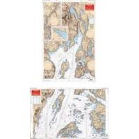
Rockport to Bangor, Maine Nautical Marine Charts - Waterproof Charts
Designed for recreational boaters, fishermen and divers. Waterproof Charts are beautifully printed on synthetic paper. For use on deck in any weather rain or spray! Accurate, used by Coast Guard and Navy, simple to use with GPS. Foldable and easy to hold and store Waterproof Charts are so tear resistant you can't ruin them. Printed on both sides so they save you money! This great chart combines 2 NOAA charts for coverage of this popular boating area. Starting in Bangor covers the Penobscot River downstream thru Bucksport to Searsport then broadens to cover Penobscot Bay, Belfast, Castine and Islesboro Island. An inset gives details of Belfast Harbor and east across the bay the coverage continues to Castine Harbor, Smith Cove and the Bagaduce River up to Northern Bay. Twenty two GPS waypoints make it easy to set up your GPS for navigating this area. Information from 2 NOAA charts 13309 and 13305. GPS datum. « less
Product Specification
-
Universal Product Identifiers
Part Number: 106
Related Products
-
MT-403FG AccuSat 406 Cat 1 EPIRB Intern GPS Non-Hazmat Withbracket
-
CH250BB/150/225 150 kHz Black Box Searchlight Sonar System. Includes 250mm Travel Hoist and Operates at 12VDC
-
Package(c127 with USA Coastal Chart, 4KW 18 Inch Digital Radome & Radar Cable)
-
CF/648P+ Platinum Plus Lake Ontario on CF
-
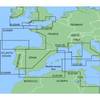
MapSource BlueChart - Irish Sea - Maps
-
ADA-M31 Dual Mount Adapter f/KVH M1 Map
-
McMurdo Fastfind Max G PLB with Built in GPS XXXXXXXX
-
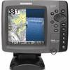
788ci HD Di Combo Down Imaging w/TM Transducer
-
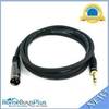
6ft Premier Series XLR Male to 1/4inch TRS Male 16AWG Cable (Gold Plated)
-
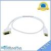
3ft 28AWG DisplayPort to DVI Cable - White
-
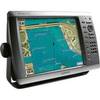
GPSMAP 4212 - Marine Chartplotter - 12.1" color - 1024 x 768
-
Matrix 97 Sonar - Fishfinder - included transducer : XNT-9-20-T - dual-beam