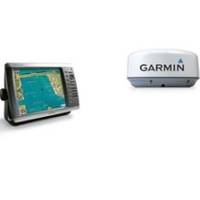
Radar 4212 Package with GMR18 4KW Radome
Model: GMR18 Brand: Garmin
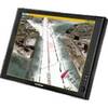
The package includes Garmin GPS Chartplotter Garmin GPS Antenna Garmin Radome Garmin Power, GPS, and Radar cables Manuals This preloaded, offshore chartplotter combines the power of networking with brilliant color and slim-line design. The GPSMAP 4212 has preloaded BlueChart g2 maps of the U.S. coast and displays them on a whopping 12.1? XGA display with crisp, video-quality resolution. By connecting to the Garmin Marine Network, you can add sonar, radar and weather. For even more enhanced features, you can add the optional Bluechart g2 Vision card. View Detailed Graphics and Video The 4212 features highly-detailed BlueChart g2 marine cartography of the coastal United States, including Alaska, Hawaii and the Bahamas. This data provides detailed coastlines, shaded depth contours, navaids, port plans, wrecks, restricted areas and tide and current information. For other areas, the 4212 has a worldwide basemap with high-quality satellite images in place of more traditional maps. With the SD card slot, you can add additional maps without having to connect to a computer. The 4212? s high-speed processor draws maps quickly, and its simple intuitive interface makes navigating easy. To keep tabs on your engine room or other area of your boat, you can also connect a live video feed with the 4212? s video input and output options. Add Extras with BlueChart g2 Vision With the optional BlueChart g2 Vision SD card, you can add a whole new dimension of exceptional features to your chartplotter. 3D mariners eye view or fish eye view provides you with a 3-dimensional perspective of map information, both above the waterline and below it. High-resolution satellite images and aerial photographs help you orient yourself in unfamiliar areas. Auto guidance technology searches through all relevant charts to create a route you can actually follow one that avoids obstacles, shallow water, buoys and other obstructions. Connect to the Garmin Marine Network The 4212 connects easily to the high-speed Garmin Marine Network, so you can interface with additional MFDs and add remote sensors. Once connected, you can share information between the 4212 and other chartplotters on your boat. You can also add high-powered radar, sonar and XM satellite weather and radio to your system. D, Jan, 2008 | Download NMEA 2000 Network Fundamentals, Rev. A, Jan, 2008 | Download Owner's Manual, Rev. A, Jan, 2008 | Download Quick Reference Guide, Rev. B, Jan, 2008 | Download EL Quick Reference Guide, Rev. B, Jan, 2008 | Download RU Quick Reference Guide, Rev. B, Jan, 2008 | Download Some downloads may require Adobe Acrobat Reader. Download a free copy here . « less
Product Specification
-
Universal Product Identifiers
Part Number: gmrpack40
Related Products
-
SP-80MS Autopilot for Cable Steer Straight Helms st80ms
-
SP110VF-5 SP-110 System w/Virtual Feedback & Mechanical Drive U
-
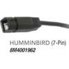
8M4001962 Tour Series Sonar Adapter Humminbird 7 Pin
-
1100 Series 1197c SI Combo NVB - Fishfinder - included transducer : XHS-9-HDSI-180-T - dual-beam
-
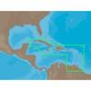
NA-C501 Furuno FP Format Cuba - Trinidad & T
-
Nauticomp Signature 12 Inch Sunlight Marine Display, Flush Mount
-
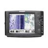
587ci HD Di Fish Finder GPS Combo #408480-1
-
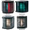
Marine Navigation Lights for Boats to 65'7" Starboard Series
-
75ft 24AWG Cat5e 350MHz UTP Bare Copper Ethernet Network Cable - Purple
-
Trident Marine Hose 4" x 6" Fiberglass Splicer
-
PVC Splice Connector for 3/8 Inch Rope Light - Imt-ilmdl-spl
-
Pro Series HD Thru-Hull Underwater Light, 3010TH-HD