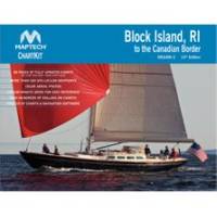
PAPR07; Region 7 Paper Chart Kit
Model: PAPR07 Brand: Maptech
ChartKits are full-color reproductions of U.S. government and private charts spiral bound into popular cruising regions with aerial photos pre-plotted courses and more. The convenient-sized books are large enough to allow for manual plotting yet small enough to sit on your nav-station or lap. Waterproof covers are available. « less
Product Specification
-
Universal Product Identifiers
Part Number: PAPR07
Related Products
-
1158c High Definition External GPS & Fishfinder with Transom Mount Transducer 39688
-
3G Broadband Radar Kit (000-10418-001)
-
1835 4KW 24" Dome 10. 4" Color LCD Radar
-
2-014 Outdoor US Northeast Chart for Endura Series
-
Package(c125 with USA Coastal Chart, 4KW 18 Inch Digital Radome & Radar Cable)
-
T52085 RA1048SHD - 4KW 48 in. in. Super HD
-
010-C0773-10 Bluechart G2 HEU015RAegean Sea & Sea of Marmara
-
Series 50 Classic Stainless Steel Navigation Lights
-
6ft 28AWG Dual Link DVI-D M/F Extension Cable - Black
-
DA82S 3' Cell Adapter Cable
-
Parts Express Marine Grade Locking Cigarette Lighter Plug 12 VDC
-
EF2400iHC - 2400 watts/16.7 Amps Portable Inverter Generator - EF2400iHC