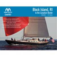
PAPR06; Region 6 Paper Chart Kit
Model: PAPR06 Brand: Maptech
ChartKits are full-color reproductions of U.S. government and private charts spiral bound into popular cruising regions with aerial photos, pre-plotted courses and more. The convenient-sized books are large enough to allow for manual plotting, yet small enough to sit on your nav-station or lap. Waterproof covers are available. « less
Product Specification
-
Universal Product Identifiers
Part Number: PAPR06
Related Products
-
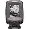
PiranhaMAX 180 - Fishfinder - included transducer : XNT-9-QB-90-T - triple-beam
-
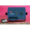
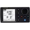
Explorer + Black Box Chartplotter without GPS Sensor
-
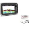
Package(e7D with Sonar & USA Coastal Chart, 4KW 18 Inch Digital Radome & Radar Cable)
-
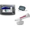
Package(C120W, DSM300G Sounder, RA1048D 4KW 48 Inch HD Digital Open Array Radar & 15m Radar Cable)
-
NAVPILOT 700 High-Performance, Universal Autopilot Package
-
Series 50 Classic Stainless Steel Navigation Lights
-
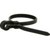
Mountable Head Cable Tie 4 Inch 18LBS, 100pcs/Pack - Black
-
Marine Products Plug Wire Set 9-28011
-
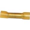
EC64230 Connector
-
Air Breeze 1-ARBM-15-24 Marine Wind Generator 24VDC
-
Dish Solo ViP211k HD Satellite Receiver
-
E22158 SeaTalk 1 to SeaTalk NG Converter Kit