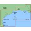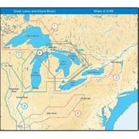
NT+ Wide Map, Mississippi and Illinois Rivers
Model: Brand: C-Map
C-MAP has set the standard for electronic charts with five consecutive NMEA awards for "Best Electronic Cartography". Built on the incredible success of C-MAP NT+, NT+ Wide combines a generation of chartplotters with efficient performance plus real-time accuracy and detail. Now you will be able to see slip detail as well as the locations for onshore facilities. « less
Product Specification
-
Universal Product Identifiers
Part Number: NA-C040GTIN: 00686074004016
Related Products
-
Chart Weight, Compass, Nickel
-
MapSource BlueChart - Morgan City-Brownsville - Maps
-
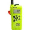
SR203 VHF GMDSS Survival Radio
-
39161 Round Bronze Strainer, for Thru-Hull Size 1"
-
Low Profile Wall Mount Bracket for LCD LED Plasma (Max 165Lbs, 23~37inch) - Black
-
40 Stern Yellow Nav Light 12v/10w
-
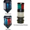
70M Double Starboard Nav Light
-
Hook & Loop Fastening Cable Ties 6inch, 10pcs/Pack - Yellow
-
0.5meter SATA Serial ATA Cable (90 Degree - Right Angle)
-
20110003 SP-36 Second Station Kit W/25' Cable
-
Th-1202-B Thru Hull 1-1/8" White 1-1/4" Hull
-
8.0 Sbeg Generator