Nautical Charts [Book]
This historic book may have numerous typos and missing text. Purchasers can download a free scanned copy of the original book (without typos) from the publisher. Not indexed. Not illustrated. 1908 edition. Excerpt: ...the 2, 4, 6, 10, and 20 meter and various deeper curves, and the French the 2, 5, 10, and 20 meter and deeper curves. On the United States Lake Survey charts the areas included within the 6, 12, and 18 foot curves are shaded with a blue tint, heavy along the outer edge, which brings out strongly the shoal areas. Depth curves if clearly shown are a great aid in interpreting the hydrography and making plain the shoals and passages. The system of curves should always be understood when using a chart, and it may sometimes aid the navigator to trace out with a pencil an additional curve, if needed, beyond the draft of his vessel. The abbreviations used for the bottom characteristics are explained either on the chart or on the sheet of chart symbols, and give information which is useful in anchoring, and may be helpful in identifying a position by soundings. When a sounding is made without the lead reaching bottom, the depth obtained is sometimes shown on the chart by a short line and zero above the figure, indicating that at the depth stated, bottom was not obtained (no bottom). There are a few important symbols shown in the water area of charts. The sunken rock symbol indicates a dangerous area, or a danger having a moderate depth of water over it, or a rock the least water over which is not known; ordinarily on the United States charts the least depth will be stated when known, and the symbol omitted. The rock awash symbol indicates a rock awash at some stage of the tide, unless more definitely stated. The position of a wreck is indicated by a special symbol. P. D. (position doubtful) and E. D. (existence doubtful) are placed after soundings or rocks or other features which depend on some doubtful report not yet verified. The following are the... « less
Product Specification
-
Authors: George Rockwell PutnamPages: 64Format: paperbackPublication Date: 2012.06
-
Universal Product Identifiers
ISBN: 0217433995GTIN: 09780217433990
Related Products
-
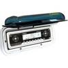
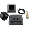
Electronics - F-MH - Marine Stereo Housing
-
C97 Multifunction 9" Display with Sonar - European Charts T70023 c44025
-
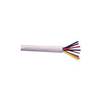
350 8 Conductor Cable
-
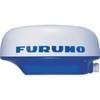
2.2KW 18 Radome 24 NM Range 5.2 Deg Beam 182x
-
5ft 24AWG Cat6 550mhz UTP Ethernet Bare Copper Network Cable - Red
-
ACR Globalfix iPro - Category II manual Release
-
GHP 10 Marine Autopilot System (322-0100070500)
-
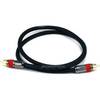
240-182 Digital Coaxial/Subwoofer Audio Cable 3 ft. CL2
-
Skt 430BN 30 ft Speakon to Banana Speaker Cable
-
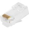
GC7266 Solid Cat6 RJ45 Plug (100-Pack)
-
Marine Remote Control Y Connector - MS-WR100Y - MS-WR100Y
-
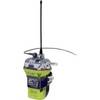
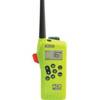
2829 SR203 VHF GMDSS Survival Radio