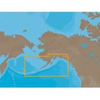
NA-C802 Furuno FP Format Gulf of Alaska
Model: NA-C802 Brand: C-Map
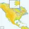
With are Electronic Sharts C-Maps we have: Olympia, Washington to Port Mcneill, British Columbia. Nannose to Victoria to Cape Scott Texada Island to Caamano Sound Cape Caution to Portland Canal Banks Island, British Columbia to Sumner Strait, Alaska Dixon Entrance to Icy Bay Gulf of Alaska Western Alaska NA-C802 Gulf of Alaska NT+ Cartography NT+ electronic charts feature much wider coverage areas at substantially lower prices. « less
Product Specification
-
Universal Product Identifiers
Part Numbers: 20185, NA-C802, NA-C802FURUNOFPGTIN: 00686074002258
Related Products
-
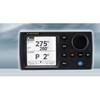
NAVPILOT 700OB Autopilot for Outboard without Pumpset
-
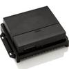
AC70 Autopilot Computer 000-10186-001
-
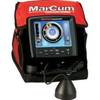
LX-7 Color LCD Sonar
-
Max Lakes North NA-M017 c30544
-
Great Lakes and The Maritimes NA-M026 c30127
-
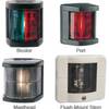
Marine 3562 Series Navigation Lights Starboard Light, 1nm
-
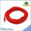
20ft 24AWG Cat6 550mhz UTP Ethernet Bare Copper Network Cable - Red
-
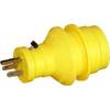
30 Amp to 15 Amp 125 Volt Hand Adapter Yellow
-
SB10BL Switch Box 2 UNITS-1 Ducer Blue Connector
-
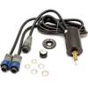
010-11324-00 - Gra 10 Rudder Angle Adpt
-
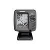
300 Series 365i Combo - Marine Chartplotter - 4" monochrome - 240 x 320
-
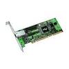
PRO/1000 MT Server Adapter Network adapter - PCI-X hot-plug 133 MHz